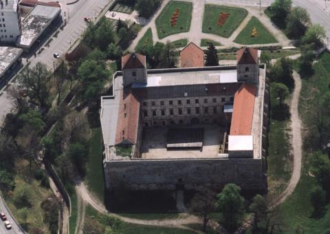
Varpalota

Varpalota
Várpalota
Wappen fehlt
Hilfe zu Wappen
Várpalota (Ungarn)
DEC
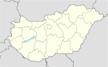
Basisdaten
Staat: Ungarn
Region: Közép-Dunántúl
(Mittel-Transdanubien)
Komitat: Veszprém
Koordinaten: 47° 12′ N, 18° 8′ O47.19728888888918.1394805555567Koordinaten: 47° 11′ 50″ N, 18° 8′ 22″ O
Fläche: 87,59 km²
Einwohner: 21.203 (2006)
Bevölkerungsdichte: 242 Einwohner je km²
Struktur und Verwaltung
Webpräsenz:

Várpalota [ˈvaːrpɒlotɒ] ist eine Stadt im mittleren Ungarn, etwa 70 km südwestlich von Budapest im Komitat Veszprém.

Inhaltsverzeichnis

Geographie

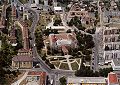
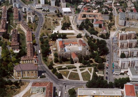
Várpalota liegt am Ostabfall des Bakonywalds, etwa 20 km östlich der nur wenig größeren Komitatshauptstadt Veszprém und auf halbem Weg nach Székesfehérvár. Das Ostende des Plattensees (Balaton) befindet sich 15–20 km südlich der Stadt.

Die Fläche der Stadtgemeinde beträgt 87,59 km². Die Bevölkerung ist in den letzten 20 Jahren um ein Viertel gesunken.

Einwohnerentwicklung

  • 1985: 28.531
  • 1990: 26.928
  • 2001: 21.779
  • 2006: 21.203

Wirtschaft

Zu sozialistischen Zeiten war Várpalota ein wichtiger Bergbau- und Industriestandort. Nach 1990 setzte ein wirtschaftlicher Niedergang ein, alle Minen wurden geschlossen. Eine gewisse Bedeutung haben – jedoch weniger als früher – die Aluminium-Verarbeitung und die chemische Industrie.

Galerie


Weblinks


Wikimedia Foundation.

Игры ⚽ Нужно решить контрольную?

Schlagen Sie auch in anderen Wörterbüchern nach:

  • Várpalota — Escudo …   Wikipedia Español

  • Várpalota — Várpalota …   Deutsch Wikipedia

  • Várpalota — Héraldique …   Wikipédia en Français

  • Várpalota —   [ vaːrpɔlotɔ], Stadt im Bezirk Veszprém, Ungarn, am Nordostfuß des Bakonywaldes, 26 500 Einwohner; Industriemuseum; Schwerindustrie (Aluminiumhütte, Erdölraffinerie, Düngemittelfabrik) auf der Basis der Braunkohlenförderung und Energieerzeugung …   Universal-Lexikon

  • Várpalota — Infobox Settlement subdivision type = Country subdivision name = HUN timezone=CET utc offset=+1 timezone DST=CEST utc offset DST=+2 pushpin pushpin label position = pushpin map caption =Location of Várpalota pushpin mapsize = official… …   Wikipedia

  • Varpalota — Sp Várpalota Ap Varpalota L Vengrija …   Pasaulio vietovardžiai. Internetinė duomenų bazė

  • Varpalota — Original name in latin Vrpalota Name in other language Varpalota, Vrpalota State code HU Continent/City Europe/Budapest longitude 47.19936 latitude 18.13954 altitude 158 Population 21299 Date 2012 02 02 …   Cities with a population over 1000 database

  • Kleingebiet Várpalota — Das Kleingebiet Várpalota (ungarisch várpalotai kistérség) ist eine ungarische Verwaltungseinheit (LAU 1) innerhalb des Komitat Várpalota in Ungarn. Der Verwaltungssitz ist Várpalota. Ortschaften Die folgenden Ortschaften gehören zum Kleingebiet… …   Deutsch Wikipedia

  • Варпалота — (Várpalota)         город в Венгрии, в медье Веспрем, у северных отрогов гор Баконь. Образован в 1952 в результате объединения В. с соседними посёлками Пет и Инота. 27 тыс. жителей (1967). Свыше активного населения занято добычей угля (в… …   Большая советская энциклопедия

  • Mihály Cseszneky — de Cseszneg was a Hungarian nobleman and border castle hero in 16th century. Member of the Cseszneky family.Mihály Cseszneky was appointed chief lieutenant to the Castle of Várpalota in 1559, after he and Balázs Baranyai had liberated several… …   Wikipedia

Share the article and excerpts

Direct link
Do a right-click on the link above
and select “Copy Link”