Woollahra

Woollahra
Municipality of Woollahra
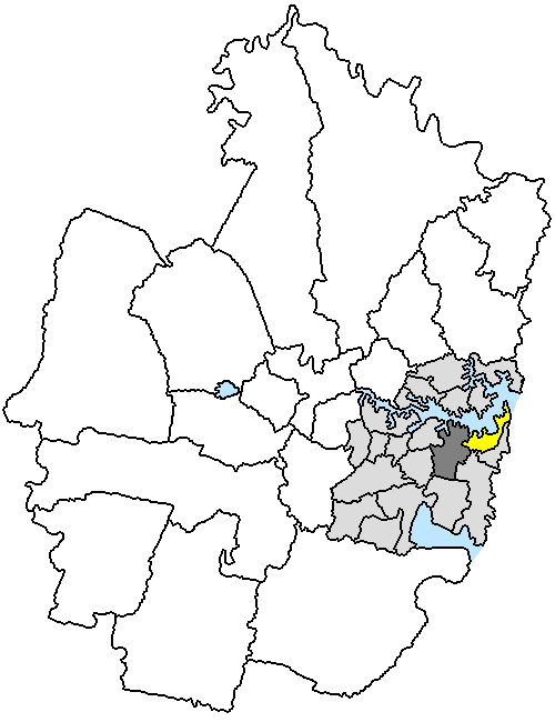
Lage der Woollahra Municipality in Sydney
Basisdaten
Bundesstaat: New South Wales
Hauptort: Double Bay
Fläche: 12 km²
Einwohner: 53.667 (Juni 2006)
Wards: 5
Stadtteile: 15

Die Municipality of Woollahra ist ein lokales Verwaltungsgebiet (LGA) im australischen Bundesstaat New South Wales. Woollahra gehört zur Metropole Sydney, der Hauptstadt von New South Wales. Das Gebiet ist 12 km² groß und hat etwa 54.000 Einwohner.

Woollahra liegt südlich der Hafenöffnung von Sydney östlich des Stadtzentrums. Das Gebiet beinhaltet 15 Stadtteile: Bellevue Hill, Darling Point, Double Bay, Edgecliff, HMAS Rushcutters, HMAS Watson, Point Piper, Watsons Bay, Woollahra und Teile von Diamond Bay, Paddington, Rose Bay, Rose Bay North, Vaucluse und Vaucluse Heights. Der Verwaltungssitz des Councils befindet sich im Stadtteil Double Bay im Westen der LGA.

Verwaltung

Der Woollahra Municipal Council hat 15 Mitglieder, die von den Bewohnern der fünf Wards gewählt werden (je drei aus Bellevue Hill, Cooper, Double Bay, Paddington und Vaucluse Ward). Diese fünf Bezirke sind unabhängig von den Stadtteilen festgelegt. Aus dem Kreis der Councillor rekrutiert sich auch der Mayor (Bürgermeister) des Councils.

Weblinks

-33.883333333333151.257Koordinaten: 33° 53′ S, 151° 15′ O


Wikimedia Foundation.

Игры ⚽ Поможем сделать НИР

Schlagen Sie auch in anderen Wörterbüchern nach:

  • Woollahra — Admin ASC 2 Code Orig. name Woollahra Country and Admin Code AU.02.18500 AU …   World countries Adminstrative division ASC I-II

  • Woollahra Public School — Woollahra Public School, previously known as Woollahra Demonstration School for many years, is a main school located in the Eastern suburbs of Sydney, Australia in the suburb of Woollahra. As well as containing classes from kindergarten to year 6 …   Wikipedia

  • Woollahra railway station, Sydney — Sydneyclosedstation NAME= Woollahra LINE=Eastern Suburbs DISTANCE= 5.8 km PLATFORMS= 2 TRACKS= 2 STATUS=Incomplete OPENED= Not completed CLOSED= Not completed http://maps.google.com/?q= 33.885162%2C%20151.242913%20(Woollahra%20station%2C%20incompl… …   Wikipedia

  • Woollahra, New South Wales — Infobox Australian Place | type = suburb name = Woollahra city = Sydney state = nsw caption = Phoenix Hotel, Moncur Street lga = Municipality of Woollahra est = postcode = 2025 pop = area = propval = [http://www.domain.com.au/public/SuburbProfile …   Wikipedia

  • Woollahra Municipality — Municipality of Woollahra Lage der Woollahra Municipality in Sydney Gliederung …   Deutsch Wikipedia

  • Electoral district of Woollahra — Woollahra was an electoral district of the Legislative Assembly in the Australian state of New South Wales, originally created with the abolition of multi member constituencies in 1894 from part of Paddington, along with Waverley and Randwick. It …   Wikipedia

  • Municipality of Woollahra — New South Wales Population: 55,228(2009) …   Wikipedia

  • Municipalité de Woollahra — 33° 53′ 00″ S 151° 15′ 00″ E / 33.883333, 151.25 …   Wikipédia en Français

  • Rose Bay, New South Wales — Infobox Australian Place | type = suburb name = Rose Bay city = Sydney state = nsw caption = Boats on the shore of Rose Bay lga = Waverley Council postcode = 2029 est = pop = [http://www.censusdata.abs.gov.au/ABSNavigation/prenav/ProductSelect?new… …   Wikipedia

  • Eastern Suburbs railway line, Sydney — main|Eastern Suburbs Illawarra railway line, SydneyPublic transport infrastructure in Sydney logo= name=Eastern Suburbs Line transport mode=Commuter rail line owner=CityRail operation area=City of Sydney Municipality of Woollahra Waverley… …   Wikipedia

Share the article and excerpts

Direct link
Do a right-click on the link above
and select “Copy Link”