- Ziebach County (South Dakota)
-
Verwaltung US-Bundesstaat: South Dakota Verwaltungssitz: Dupree Adresse des
Verwaltungssitzes:Gründung: 1911 Gebildet aus: Vorwahl: {{{VORWAHL}}} Demographie Einwohner: 2706 (2006) Bevölkerungsdichte: 0,5 Einwohner/km² Geographie Fläche gesamt: 5.105 km² Wasserfläche: 23 km² Karte 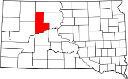
Ziebach County ist ein Bezirk in South Dakota, Vereinigte Staaten. Er ist einer der ärmsten Bezirke in den Vereinigten Staaten. Der Verwaltungssitz ist in Dupree.
Geographie
Der Bezirk hat eine Fläche von 5.105 km² und ist somit etwa ein Viertel so groß wie Hessen. Davon sind etwa 5.082 km² Land und 23 km² (0,44 %) Wasserfläche. Der Bezirk ist in drei unorganisierte Territorien eingeteilt: Dupree, North Ziebach und South Ziebach.
Reservate
Fast der gesamte Bezirk liegt innerhalb des Cheyenne-River-Reservats, einem Indianerreservat. Ein kleiner Teil des Bezirkes an seiner nördlichsten Grenze gehört zum Standing-Rock-Reservat, damit ist Ziebach einer von 5 Bezirken Süddakotas, die vollständig in Reservaten liegen.
Geschichte
Der Bezirk ist nach Francis M. Ziebach, dem ersten Gouverneur South Dakotas, benannt. Er wurde 1830 nahe Lewisburg, Pennsylvania geboren. Gestorben ist er mit 99 Jahren am 20. September 1929.

Aurora | Beadle | Bennett | Bon Homme | Brookings | Brown | Brule | Buffalo | Butte | Campbell | Charles Mix | Clark | Clay | Codington | Corson | Custer | Davison | Day | Deuel | Dewey | Douglas | Edmunds | Fall River | Faulk | Grant | Gregory | Haakon | Hamlin | Hand | Hanson | Harding | Hughes | Hutchinson | Hyde | Jackson | Jerauld | Jones | Kingsbury | Lake | Lawrence | Lincoln | Lyman | Marshall | McCook | McPherson | Meade | Mellette | Miner | Minnehaha | Moody | Pennington | Perkins | Potter | Roberts | Sanborn | Shannon | Spink | Stanley | Sully | Todd | Tripp | Turner | Union | Walworth | Yankton | Ziebach

Wikimedia Foundation.