- AMNWR
-
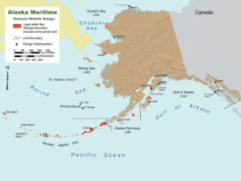 Karte des AMNWR mit rot gekennzeichneten Schutzgebieten
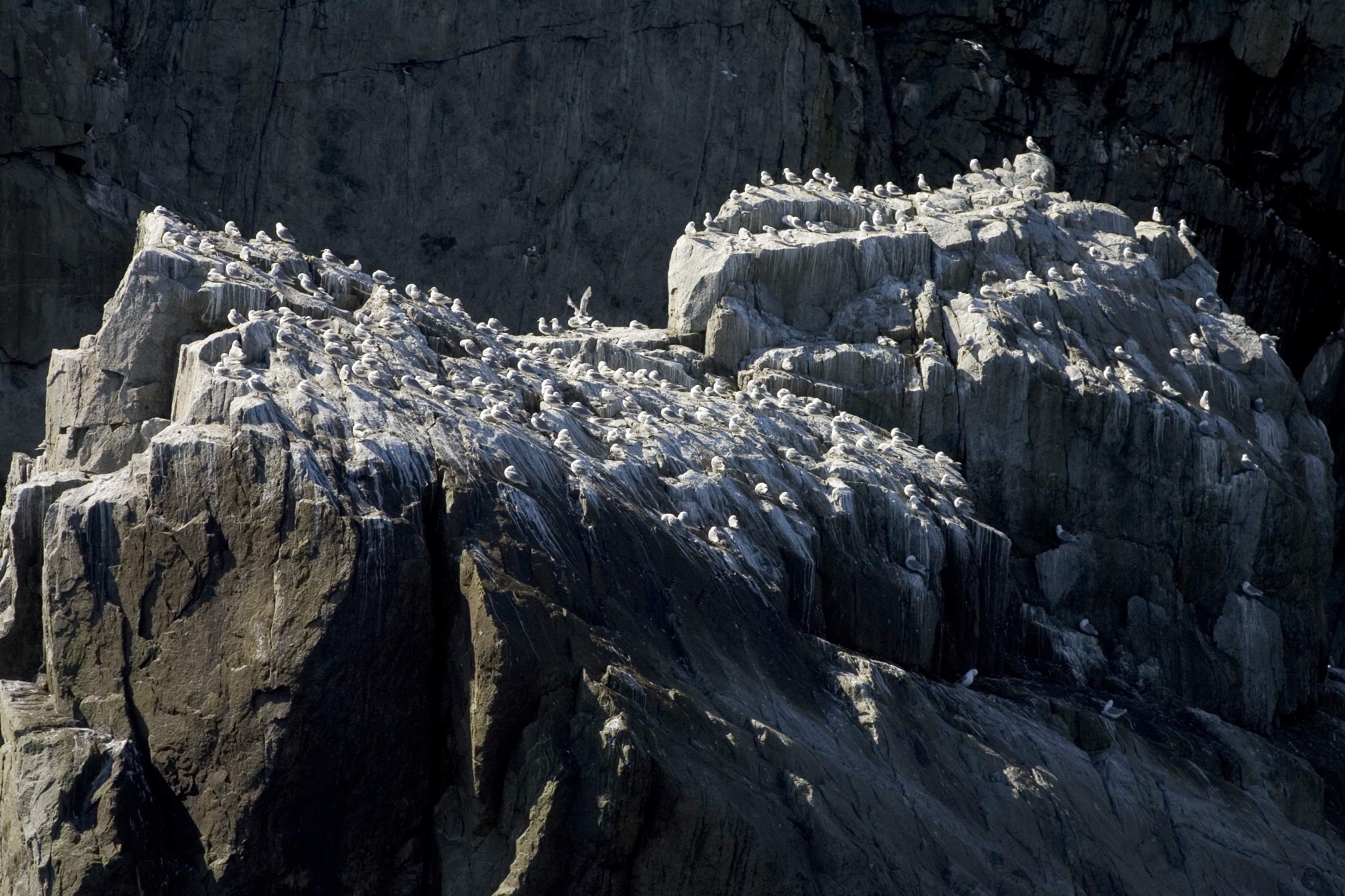
 Dreizehenmöwen im Alaska Maritime National Wildlife Refuge
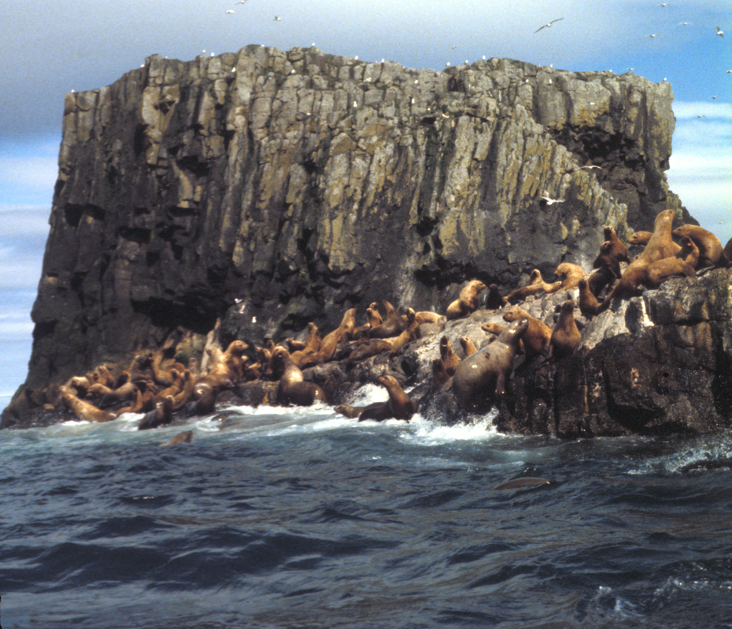
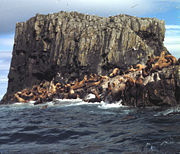 Seelöwenkolonie auf den Aiugunak Pinnacles
Das Alaska Maritime National Wildlife Refuge (AMNWR) ist ein 16.190 km² großes Naturschutzgebiet, das etwa 2500 Inseln, Buchten und Riffe entlang der Küste des US-Bundesstaats Alaska umfasst. Es erstreckt sich von Kap Lisburne im Nordwesten der Lisburne-Halbinsel bis Forrester Island im Süden des Alaska Panhandle und beinhaltet unter anderem die Küste vor der Alaska-Halbinsel, das Kodiak-Archipel, die Pribilof Islands und die Aleuten.
Inhaltsverzeichnis
Geschichte
Das Alaska Maritime Refuge besteht in seiner heutigen Form seit 1980, als mit dem Alaska National Interest Lands Conservation Act elf bereits existierende Schutzgebiete zusammen mit weiteren Regionen zu einem großen Schutzgebiet zusammengefasst wurden. Die Ursprünge gehen bis zum Beginn des 20. Jahrhunderts zurück, als unter Theodore Roosevelt das National Wildlife Refuge System entstand.
Tierwelt
Etwa 75 % der einheimischen Seevögel Alaskas leben im AMNWR. Geschätzte 40 Millionen Seevögel, 80 % des nordamerikanischen Seevogelbestands, nisten in dieser Region. Auch Seelöwen, Robben, Walrosse und Seeotter kommen in den Gewässern des Alaska Maritime National Wildlife Refuge vor.
Enthaltene Schutzgebiete
- Bering Sea Refuge (1909)
- Pribilof Islands Refuge (1909)
- St. Lazaria Refuge (1909)
- Tuxedni Refuge (1909)
- Bogoslof Refuge (1909)
- Forrester Island Refuge (1912)
- Hazy Islands Refuge (1912)
- Chamisso Refuge (1912)
- Aleutian Islands Refuge (1913)
- Semidi Island Refuge (1932)
- Simeonof Island Refuge (1958)
(in Klammern das jeweilige Gründungsjahr)
Einteilung
Das Alaska Maritime National Wildlife Refuge ist in fünf Units, geographische Bereiche, eingeteilt:
Golf von Alaska
- Forrester Island Wilderness (Forrester Island, Lowrie Island, Wolf Rock)
- Hazy Islands Wilderness (Hazy Islands
- Saint Lazaria National Wildlife Refuge (St. Lazaria Island)
- Middleton Island
- Chiswell Islands
- Tuxedni Wilderness (Chisik Island, Duck Island und Egg Island)
- Barren Islands (East Amatuli Island, West Amatuli Island, Ushagat Island und andere)
- Trinity Islands (Sitkinak Island, Tugidak Island und andere)
Alaska-Halbinsel
- Sutwik Island
- Semidi Islands (Aghik Island, Chowiet Island und andere)
- Simeonof Island (Teil der Shumagin Islands)
Aleuten
- Großteil der Aleuten von Unimak Island im Osten bis Attu im Westen)
- Bogoslof Wilderness (Bogoslof Island)
Beringmeer
- Hagemeister Island
- Pribilof Islands (St. George Island, St. Paul Island, Otter Island, Walrus Island)
- Bering Sea Wilderness (St. Matthew Island, Hall Island, Pinnacle Island)
- Besboro Island
- Sledge Island
- King Island
Tschuktschensee
- Chamisso Wilderness (Chamisso Island, Puffin Island)
- Cape Thompson
- Cape Lisburne
Weblinks
- U.S. Fish & Wildlife Service: Alaska Maritime National Wildlife Refuge (offizielle Seite) (englisch)

Alaska Maritime | Alaska Peninsula | Arctic | Becharof | Innoko | Izembek | Kanuti | Kenai | Kodiak | Koyukuk | Nowitna | Togiak | Selawik | Tetlin | Yukon Delta | Yukon Flats

Wikimedia Foundation.