Béni Abbès

Béni Abbès

30.116666666667-2.16666666666677Koordinaten: 30° 7′ N, 2° 10′ W

Beni Abbes (Algerien)
DEC
Beni Abbes
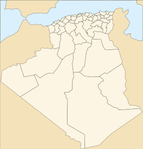
Beni Abbes
Demokratische Volksrepublik Algerien

Béni Abbès ist eine Oasenstadt mit ca. 7000 Einwohnern im Südwesten Algeriens. Sie liegt am Rande der Sandwüste Westlicher Großer Erg und befindet sich in der Provinz Bechar (Wilaya de Béchar). Die nächstgelegenen Orte, zu den Verkehrsverbindungen bestehen, sind die 247 km entfernte Provinzhauptstadt Bechar und das 350 km entfernte Timimoun.

In Beni-Abbes befindet sich ein Saharamuseum und ein Sahara-Forschungszentrum. Es gibt alte Befestigungsanlagen (Ksar von Beni Abbes). In der Nähe der Befestigungsanlagen liegen bis zu 140 m hohe Sanddünen. Die 1901 gegründete Eremitage La Fraternite, in der Charles de Foucauld vier Jahre lang lebte, besitzt noch eine Kapelle wird aber nicht mehr von Mönchen bewohnt.

Beni-Abbes wurde im 11. Jahrhundert gegründet und bestand zunächst aus vier unabhängigen befestigten Siedlungen (Ksars). Sidi Muhamed ben Abdeslam vereinigte diese dann im 15. Jahrhundert zu einem einzigen Ort.

Quellen


Wikimedia Foundation.

Игры ⚽ Нужен реферат?

Schlagen Sie auch in anderen Wörterbüchern nach:

  • Beni-Abbes — Béni Abbés Béni Abbés Géographie Pays …   Wikipédia en Français

  • Beni Abbes — Béni Abbés Béni Abbés Géographie Pays …   Wikipédia en Français

  • Béni-Abbès — Béni Abbés Béni Abbés Géographie Pays …   Wikipédia en Français

  • Béni-Abbés — Géographie Pays …   Wikipédia en Français

  • Beni Abbes — Saltar a navegación, búsqueda بني عباس / béni abas beni abbes Escudo …   Wikipedia Español

  • Béni Abbès — is the capital city of the Béni Abbès District in southwest Béchar Province, Algeria. It has a population of 13,000.HistoryInitial settlingThe first settlers in the area were from the Beni Hassan tribe; they migrated to Saguia el Hamra and… …   Wikipedia

  • Beni Abbes — Beni Abbes …   Deutsch Wikipedia

  • Béni Abbès — Pour les articles homonymes, voir Beni (homonymie) et Abbes. Béni Abbès Ajouter une image Administration Nom alg …   Wikipédia en Français

  • Béni Abbes — Infobox City official name = Beni Abbes nickname= image mapsize = map caption = pushpin pushpin label position = subdivision type = Country subdivision type1 = Province subdivision name = Algeria subdivision name1 = Béchar leader title = leader… …   Wikipedia

  • Beni Abbès — ▪ Algeria       oasis town, west central Algeria. It lies on the western edge of the Grand Erg (sand dunes) Occidental. The Wadi Saoura divides the stony desert and the sand dunes to the east and south. Beni Abbès is a small town of roofed… …   Universalium

Share the article and excerpts

Direct link
Do a right-click on the link above
and select “Copy Link”