Canefield Airport

Canefield Airport
Canefield Airport
BW
Canefield Airport (Dominica)
Red pog.svg
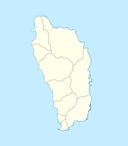
Kenndaten
IATA-Code DCF
ICAO-Code TDCF
Koordinaten
Verkehrsanbindung
Entfernung vom Stadtzentrum 2 km nördlich von Roseau
Basisdaten
Eröffnung
Start- und Landebahn
01/19 954 m × 23 m Asphalt

i1 i3 i5

i8 i10 i12

i14

Der Canefield Airport (IATA-Code DCF, ICAO-Code TDCF) ist einer der beiden Flughäfen des karibischen Inselstaats Dominica. Er liegt etwa 2 km nördlich von Roseau.

Die Rollbahn des Flughafens ist mit unter 1.000 Metern zu kurz für moderne Jets und lässt sich auch aufgrund der Lage kaum erweitern. Der Flughafen verfügt über keine internationale Zulassung und kein Instrumentenlandesystem und wird daher nur tagsüber und bei guter Sicht von Regierungs- oder Privatmaschinen angeflogen. Mit dem Ausbau des Melville Hall Airport, der sich ca. 30 Kilometer entfernt an der Nordostküste der Insel befindet und seit Ende 2010 über ein Instrumentenlandesystem verfügt, hat die Bedeutung des Canefield Airport stark nachgelassen.

Weblinks


Wikimedia Foundation.

Игры ⚽ Поможем написать курсовую

Schlagen Sie auch in anderen Wörterbüchern nach:

  • Canefield Airport — Infobox Airport name = Canefield Airport nativename = nativename a = nativename r = image width = caption = IATA = DCF ICAO = TDCF type = Public owner = operator = city served = Roseau location = Dominica elevation f = 13 elevation m = 4 website …   Wikipedia

  • Canefield — is a community located on the west coast of Dominica. The largest settlement in St. Paul Parish, it has a population of 2,803.Commonwealth of Dominica, Population and Housing Census 2001 . Roseau, Dominica: Central Statistical Office, Ministry of …   Wikipedia

  • Flughafen Roesau Canefield — Canefield Airport …   Deutsch Wikipedia

  • Flughafen Roseau Canefield — Canefield Airport …   Deutsch Wikipedia

  • Melville Hall Airport — IATA: DOM – ICAO: TDPD Summary Airport type Public Owner Government Of Dominica Operator Domini …   Wikipedia

  • E. T. Joshua Airport — Infobox Airport name = E.T. Joshua Airport nativename = nativename a = nativename r = image width = caption = IATA = SVD ICAO = TVSV type = Public owner = operator = city served = location = Kingstown elevation f = 66 elevation m = 20 coordinates …   Wikipedia

  • John A. Osborne Airport — IATA: MNI – ICAO: TRPG Summary Airport type Public Location Montserrat Elevation AMSL …   Wikipedia

  • TDCF — Canefield Airport …   Deutsch Wikipedia

  • Carib Aviation — Infobox Airline airline = Carib Aviation logo size = 350 fleet size = 8 destinations = 14 IATA = 3Q ICAO = DEL callsign = RED TAIL parent = Carib Aviation Limited company slogan = founded = 1972 headquarters = Antigua key people = Bruce Kaufman… …   Wikipedia

  • Dominica — Not to be confused with the Dominican Republic. Commonwealth of Dominica Commonwealth de la Dominique …   Wikipedia

Share the article and excerpts

Direct link
Do a right-click on the link above
and select “Copy Link”