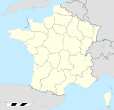
Carrépuis

Carrépuis
Carrépuis
Carrépuis (Frankreich)
Carrépuis
Region Picardie
Département Somme
Arrondissement Montdidier
Kanton Roye
Gemeindeverband keiner.
Koordinaten 49° 42′ N, 2° 49′ O49.7052777777782.8216666666667Koordinaten: 49° 42′ N, 2° 49′ O
Höhe 83–97 m
Fläche 5,5 km²
Einwohner 291 (1. Jan. 2008)
Bevölkerungsdichte 53 Einw./km²
Postleitzahl 80700
INSEE-Code
.

Carrépuis ist eine französische französische Gemeinde mit 291 Einwohnern (Stand 1. Januar 2008) im Département Somme in der Region Picardie; sie gehört zum Arrondissement Montdidier und zum Kanton Roye.

Bevölkerungsentwicklung

  • 1962: 160
  • 1968: 173
  • 1975: 215
  • 1982: 206
  • 1990: 198
  • 1999: 218
  • 2007: 283

Wikimedia Foundation.

Игры ⚽ Нужна курсовая?

Schlagen Sie auch in anderen Wörterbüchern nach:

  • Carrepuis — Carrépuis Carrépuis Pays  Franc …   Wikipédia en Français

  • Carrépuis — Saltar a navegación, búsqueda Carrépuis País …   Wikipedia Español

  • Carrépuis — French commune|name= Carrépuis x = 143 y = 42 region=Picardie departement=Somme arrondissement=Montdidier canton=Canton de Roye insee=80176 cp=80700 maire=Mme Marie Josèphe Deledalle mandat=2001 2008 alt moy=92 m alt mini=83 m alt maxi=97 m… …   Wikipedia

  • Carrépuis — 49° 42′ 19″ N 2° 49′ 18″ E / 49.7053, 2.8217 …   Wikipédia en Français

  • Pierremande — 49° 34′ 20″ N 3° 15′ 04″ E / 49.5722222222, 3.25111111111 …   Wikipédia en Français

  • Communes of the Somme department — The following is a list of the 782 communes of the Somme département, in France. (CAA) Communauté d agglomération Amiens Métropole, created in 2000. INSEE code Postal code Commune 80001 80100 …   Wikipedia

  • Montauban-de-Picardie — Montauban de Picardie …   Wikipedia

  • Ovillers-la-Boisselle — Ovillers la Boisselle …   Wikipedia

  • Drucat — Drucat …   Wikipedia

  • Corbie — For other uses, see Corbie (disambiguation). Corbie Neuville sous Corbie church …   Wikipedia

Share the article and excerpts

Direct link
Do a right-click on the link above
and select “Copy Link”