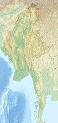
Cheduba

Cheduba

Vorlage:Infobox Insel/Wartung/Bild fehlt

Cheduba (Manaung Island)
Gewässer Indischer Ozean
Geographische Lage 18° 47′ N, 93° 38′ O18.78111111111193.630277777778140Koordinaten: 18° 47′ N, 93° 38′ O
Cheduba (Manaung Island) (Myanmar)
Cheduba (Manaung Island)
Länge 31 km
Breite 15 km
Fläche 523 km²
Höchste Erhebung 140 m
Einwohner 63.761 (1983)
122 Einw./km²

Cheduba, auch Manaung Island genannt, ist eine Insel von Myanmar (Birma) im Golf von Bengalen. Sie ist vulkanischen Ursprungs und liegt ca. 15 Kilometer südwestlich der Insel Ramree, nahe der Südwestküste von Myanmar.

Quellen & Weblinks


Wikimedia Foundation.

Игры ⚽ Нужно решить контрольную?

Schlagen Sie auch in anderen Wörterbüchern nach:

  • Cheduba — (también llamada Manaung) es una isla de la bahía de Bengala cercana a Ramree, perteneciente a Birmania es poblada por bamar (birmanos) y arakanese. Contenido 1 Historia 2 Descripción 3 Notas …   Wikipedia Español

  • Cheduba — (spr. Dscheduba), Insel im Bengalischen Meerbusen an der Westküste der Hinterindischen Halbinsel (Asien), zur Provinz Arracan der Indo Britischen Präsidentschaft Bengalen gehörig; vulkanisch; sehr fruchtbar; Producte: Baumwolle, Reis, Zucker,… …   Pierer's Universal-Lexikon

  • Cheduba Island — (Burmese: မာန်အောင်ကျွန်း; also known as Manaung Island) is an island in the Bay of Bengal close to Ramree Island belonging to Burma. It has an area of approximately 523 km² and a population 63,761 as of 1983 which is composed chiefly of Burmans… …   Wikipedia

  • Cheduba (1863) — Career (UK) Name: SS Cheduba Owner: British India Steam Navigation Company Glasgow Builder: A. J. Inglis, Pointhouse …   Wikipedia

  • Cheduba Island — ▪ island, Myanmar also called  Manaung Island,         island in the Bay of Bengal, southwestern Myanmar (Burma). It lies about 30 miles (50 km) west of Taungup on the Arakan Coast and is separated from Ramree Island to the north by the Cheduba… …   Universalium

  • Cheduba — geographical name island W Myanmar area 202 square miles (523 square kilometers), population 2635 …   New Collegiate Dictionary

  • Battle of Ramree Island — The Battle of Ramree Island was fought for six weeks during January and February 1945, as part of the British Fourteenth Army 1944/45 offensive on the Southern Front of the Burma Campaign during World War II.Ramree Island lies off the Burma coast …   Wikipedia

  • Burma Campaign 1944-1945 — Infobox Military Conflict conflict = Burma Campaign partof = the Pacific War during World War II caption = Geography of Burma date = November 1944 ndash; July 1945 place = Burma result = Allied victory casus = territory = combatant1 =… …   Wikipedia

  • Batalla de la Isla Ramree — Saltar a navegación, búsqueda Batalla de la Isla Ramree Frente del Sudeste de Asia Segunda Guerra Mundial Fecha: Enero a febrero de 1945 Lugar: Isla Ramree, Birmania Resultado: Victoria británica …   Wikipedia Español

  • HMS Newcastle (C76) — Лёгкий крейсер «Ньюкасл» HMS Newcastle (C76) Основная информация Тип Лёгкий крейсер …   Википедия

Share the article and excerpts

Direct link
Do a right-click on the link above
and select “Copy Link”