Colonia Itapebí

Colonia Itapebí
-31.338333333333-57.405277777778
Colonia Itapebí
Colonia Itapebí (Uruguay)
Colonia Itapebí
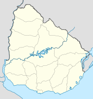
Colonia Itapebí

Colonia Itapebí auf der Karte von Uruguay

Basisdaten
Staat Uruguay
Departamento Salto
Einwohner 371 (2004)
Detaildaten
Postleitzahl 50012[1]

Colonia Itapebí ist eine Ortschaft in Uruguay.

Inhaltsverzeichnis

Geographie

Sie befindet sich auf dem Gebiet des Departamento Salto in dessen 4. Sektor. Colonia Itapebí liegt dabei in der Cuchilla del Daymán nördlich des Arroyo Itapebí Grande und westlich Rincón de Valentíns.

Infrastruktur

Colonia Itapebí liegt an der Ruta 31.

Einwohner

Die Einwohnerzahl Colonia Itapebís beträgt 371 (Stand: 2004)[2].

Jahr Einwohner
1985 -
1996 234
2004 371

Quelle: Instituto Nacional de Estadística de Uruguay[3]

Weblinks

Einzelnachweise

  1. Postleitzahlenverzeichnis der uruguayischen Post
  2. Statistische Daten des Instituto Nacional de Estadística de Uruguay 2004 als XLS-Datei
  3. Statistische Daten des Instituto Nacional de Estadística de Uruguay 1963–1996 (DOC)

Wikimedia Foundation.

Игры ⚽ Поможем решить контрольную работу

Schlagen Sie auch in anderen Wörterbüchern nach:

  • Arroyo Itapebí Grande — Arroyo Itapebí GrandeVorlage:Infobox Fluss/GKZ fehlt Lage Uruguay Flusssystem Río de la PlataVorlage:Infobox Fluss/FLUSSSYSTEM falsch Abfluss über …   Deutsch Wikipedia

  • Arroyo Tangarupá — Arroyo TangarupáVorlage:Infobox Fluss/GKZ fehlt Lage Südamerika, Uruguay Flusssystem Río de la PlataVorlage:Infobox Fluss/FLUSSSYSTEM falsch Abfluss über …   Deutsch Wikipedia

  • Arroyo del Tala (Río Arapey, linksseitig) — Arroyo del TalaVorlage:Infobox Fluss/GKZ fehlt Lage Südamerika, Uruguay Flusssystem Río de la PlataVorlage:Infobox Fluss/FLUSSSYSTEM falsch Abfluss über …   Deutsch Wikipedia

  • Rincón de Valentín — 31.282777777778 57.2 Koordinaten: 31° 17′ S, 57° 12′ W Rincón de Valentín …   Deutsch Wikipedia

  • Giuseppe Garibaldi — «Garibaldi» redirige aquí. Para otras acepciones, véase Garibaldi (desambiguación). Giuseppe Garibaldi Participó en Unificación de Italia …   Wikipedia Español

  • Муниципалитеты штата Баия — …   Википедия

  • Anexo:Ciudades de Brasil — Contenido: Arriba 0 9 A B C D E F G H I J K L M N Ñ O P Q R S T U V W X Y Z A Abadia de Goiás …   Wikipedia Español

  • Guerra de la Independencia en Entre Ríos — Parte de la Guerra de la Independencia Argentina se desarrolló en la Provincia de Entre Ríos, en donde se enfrentaron las milicias locales, y fuerzas regulares de Buenos Aires, con tropas y corsarios realistas procedentes de Montevideo y… …   Wikipedia Español

  • Mirante — is a municipality/county in the state of Bahia in Brazil. In 2004 it had a population of 16,476. See also Mirante do Paranapanema, in São Paulo v …   Wikipedia

  • Cruz das Almas — is a small city near Salvador, in the state of Bahia, in Brazil. In 2004, it had an estimated population of 56.000 inhabitants. Its climate is tropical, hot and humid. The economy is based on agriculture, especially tobacco, orange and cassava… …   Wikipedia

Share the article and excerpts

Direct link
Do a right-click on the link above
and select “Copy Link”