Conanicut Island

Conanicut Island

Vorlage:Infobox Insel/Wartung/Bild fehltVorlage:Infobox Insel/Wartung/Höhe fehlt

Conanicut Island
Gewässer Narragansett Bay, Atlantischer Ozean
Geographische Lage 41° 31′ 0″ N, 71° 23′ 0″ W41.516666666667-71.383333333333Koordinaten: 41° 31′ 0″ N, 71° 23′ 0″ W
Conanicut Island (Rhode Island)
Conanicut Island
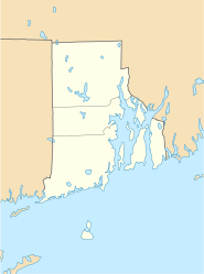
Fläche 24,46 km²
Einwohner 5.622 (2000)
230 Einw./km²
Hauptort Jamestown

Conanicut Island ist die zweitgrößte Insel im Narragansett Bay im Bundesstaat Rhode Island. Die Newport Bridge verbindet die Insel im Osten mit Aquidneck Island und Newport. Außerdem bildet die Jamestown-Verrazano Bridge die Verbindung mit North Kingstown und dem Festland. Auf der Insel liegt der Ort Jamestown. Das United States Census Bureau dokumentiert eine Landfläche von 24,46 km² und 5.622 Einwohner nach dem Zensus von 2000.

Die Insel wurde nach Häuptling Canonicus der Narraganset benannt, die die Insel bewohnten.


Wikimedia Foundation.

Игры ⚽ Нужен реферат?

Schlagen Sie auch in anderen Wörterbüchern nach:

  • Conanicut Island — from above Conanicut Island is …   Wikipedia

  • Conanicut Island — Sp Konãnikuto salà Ap Conanicut Island L V Atlante, JAV (Rod Ailandas) …   Pasaulio vietovardžiai. Internetinė duomenų bazė

  • Conanicut Island Light — Conanicut Island Lighthouse U.S. National Register of Historic Places …   Wikipedia

  • Conanicut Island — geographical name island Rhode Island in Narragansett Bay W of Aquidneck Island …   New Collegiate Dictionary

  • Conanicut Battery — U.S. National Register of Historic Places …   Wikipedia

  • Jamestown, Rhode Island — Infobox Settlement official name = Jamestown, Rhode Island settlement type = Town nickname = motto = imagesize = image caption = image mapsize = 250px map caption = Location of Jamestown in Rhode Island mapsize1 = map caption1 = subdivision type …   Wikipedia

  • Jamestown (Rhode Island) — Jamestown …   Deutsch Wikipedia

  • National Register of Historic Places listings in Newport County, Rhode Island — Location of Newport County in Rhode Island This is a list of the National Register of Historic Places listings in Newport County, Rhode Island. This is intended to be a complete list of the properties and districts on the National Register of… …   Wikipedia

  • Dutch Island (Rhode Island) — Dutch Island Light, from a early twentieth century postcard Dutch Island is an island lying west of Conanicut Island at an entrance to Narragansett Bay in Rhode Island, USA. The island is a part of the town of Jamestown, Rhode Island, and has a… …   Wikipedia

  • Dutch Island Light — Dutch Island Lighthouse U.S. National Register of Historic Places …   Wikipedia

Share the article and excerpts

Direct link
Do a right-click on the link above
and select “Copy Link”