Deschambault Lake

Deschambault Lake
Deschambault Lake

Photo-request.svg

Bild gesucht 

BW

Geographische Lage Saskatchewan (Kanada)
Inseln Robertson Island
Daten
Koordinaten 54° 47′ 0″ N, 103° 25′ 1″ W54.783333333333-103.41694444444324Koordinaten: 54° 47′ 0″ N, 103° 25′ 1″ W
Deschambault Lake (Saskatchewan)
Deschambault Lake
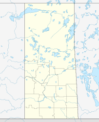
Höhe über Meeresspiegel 324 m
Fläche 532 km²[1]

Deschambault Lake ist ein See in der kanadischen Provinz Saskatchewan. Die Wasserfläche beträgt 532 km², die Gesamtfläche einschließlich Inseln beträgt 542 km².[1] Der See wird über die Seen Pelican Lake und Mirond Lake, den Fluss Sturgeon-weir River, die Seen Amisk Lake und Namew Lake sowie die White Narrows und den Fluss Tearing River zum Saskatchewan River hin entwässert.

Einzelnachweise

  1. a b Natural Resources Canada - The Atlas of Canada - Lakes

Wikimedia Foundation.

Игры ⚽ Поможем сделать НИР

Schlagen Sie auch in anderen Wörterbüchern nach:

  • Deschambault Lake — Location Saskatchewan, Canada Coordinates 53°43′13″N 103°35′29″W …   Wikipedia

  • Deschambault Lake — Sp Dešambò ẽžeras Ap Deschambault Lake L Kanadoje (Saskačevano p ja) …   Pasaulio vietovardžiai. Internetinė duomenų bazė

  • Deschambault Lake, Saskatchewan — Deschambault Lake (Kimosom Pwatinahk 203), located in the Canadian province of Saskatchewan, is a small community located approximately 90 miles (140 km) west of Flin Flon, Manitoba on highway 911. The population is 896 as of the Canada 2001 …   Wikipedia

  • Дешамбо — Эта страница требует существенной переработки. Возможно, её необходимо викифицировать, дополнить или переписать. Пояснение причин и обсуждение на странице Википедия:К улучшению/12 сентября 2012. Дата постановки к улучшению 12 сентября 2012 …   Википедия

  • List of lakes in Canada — Canada has an extremely large number of lakes. The number of lakes larger than three square kilometres is estimated at close to 31,191 by the Atlas of Canada. There is no official estimate of the number of smaller lakes. This list is at best… …   Wikipedia

  • Cree — Verbreitungsgebiet der Cree Gruppen in Kanada (nach einer Vorlage der Brock University Map Library) Die Cree (englisch, auch Kri, französisch: Les Cris) sind ein Indianervolk Nordamerikas. Ihr Stammesgebiet erstreckt sich von den Rocky Mountains… …   Deutsch Wikipedia

  • Liste der Seen in Kanada — Diese Liste enthält die 69 vom kanadischen Umweltministerium Natural Resources Canada als hauptsächliche Seen in Kanada bezeichneten Gewässer, die größer als 400 km² sind. Name Höhe Fläche Provinz Koordinaten Smallwood Reservoir 471 6527… …   Deutsch Wikipedia

  • List of Saskatchewan provincial highways — This is a list of Saskatchewan s highways:Only Highways 1, 2, 6, 7, 11, 12, and 16 contain sections of divided highway. Speed limits range from 90 km/h (55 mph) to 110 km/h (70 mph). Saskatchewan is the only province bordering the United States… …   Wikipedia

  • Peter Ballantyne Cree Nation — ( Assin skowitiniwak or Rocky Cree) is a Cree First Nations group in northern Saskatchewan consisting of eight communities: Amisk Lake, Deschambeault Lake, Kinoosao, Pelican Narrows, Prince Albert, Sandy Bay, Southend and Sturgeon… …   Wikipedia

  • Saskatchewan Highway 911 — Highway 911 is a highway in the Canadian province of Saskatchewan. It runs from Highway 106 to Deschambault Lake. Highway 911 is about 31 km (19 mi.) long …   Wikipedia

Share the article and excerpts

Direct link
Do a right-click on the link above
and select “Copy Link”