Didicas

Didicas
Didicas

Photo-request.svg

Bild gesucht 

BWf1

Höhe 228 m
Lage Insel Didicas, Babuyan-Inseln, Cagayan, Philippinen
Geographische Lage 19° 4′ 36″ N, 122° 12′ 6″ O19.076666666667122.20166666667228Koordinaten: 19° 4′ 36″ N, 122° 12′ 6″ O
Didicas (Philippinen)
Didicas
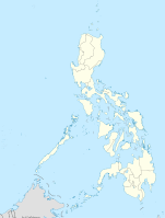
Typ komplexer Vulkan
Gestein Andesit
Letzte Eruption 1978

Der Vulkan Didicas befindet sich 22 km nordöstlich von der Insel Camiguin, Babuyan-Inseln, in der Cagayan Provinz der Philippinen. Er gehört zu den 22 aktiven Vulkanen auf den Philippinen.

Bis 1952 war der Didicas ein unterseeischer Vulkan nahe der Meeresoberfläche. Der Didicas formte die heute mit 1,4 km im Durchmesser kleine Insel in der Ausbruchsphase von 1952 und schuf den 228 Meter hohen Lavadom mit seinem 400 Meter messenden Krater.

Die ersten Aufzeichnungen über den unterseeischen Didicas stammen aus dem Jahre 1773. Die ersten Aufzeichnungen, dass der Didicas eine Insel formte, stammen von 1862 nach einer vierjährigen Ausbruchsphase, in welcher der Vulkan eine 213 Meter hohe Insel auftürmte. Diese wurde jedoch durch das Meer wieder abgetragen. Die Eruptionen von 1900 bildeten einen 82 Meter hohen Felsen und die zwei Ausbrüche von 1952 formten das heutige Eiland.

Quelle


Wikimedia Foundation.

Игры ⚽ Нужно решить контрольную?

Schlagen Sie auch in anderen Wörterbüchern nach:

  • Didicas Volcano — Didicas Volcano …   Wikipedia

  • 1990 — This article is about the year 1990. For the number, see 1990 (number). For other uses, see 1990 (disambiguation). Millennium: 2nd millennium Centuries: 19th century – 20th century – 21st century Decades: 1960s … …   Wikipedia

  • Babuyan Claro — volcano is located in the Babuyan Islands, an archipelago in the Luzon Strait and north of Luzon island in the Philippines (19°31.5 N, 121° 57 E). It is separated from Luzon by the Babuyan Channel and from the Batanes Islands up north by the… …   Wikipedia

  • Cagua Volcano — is located in northern Luzon island in the Philippines (18°13.3 N, 122°7.4 E). It is in the political jurisdiction of the province of Cagayan in the Cagayan Valley region.Physical featuresVolcanologists classify Cagua Volcano as a stratovolcano… …   Wikipedia

  • Kanlaon — Infobox Mountain Name= Mount Kanla on Photo= Mount Kanla on.jpg Caption= Mount Kanla on Elevation=2435 metres Location= Negros Island, Philippines Prominence = 2435 metres pushpin pushpin label position = left pushpin map caption = pushpin… …   Wikipedia

  • Camiguin de Babuyanes — is an active volcano on Calayan Island, one of the Babuyan Islands, (18°50 N, 121°51.6 E) in the Philippines. It is under the political jurisdiction of the province of Cagayan in the admnistrative region of Cagayan Valley.Physical… …   Wikipedia

  • Iraya — Iraya, or Mount Iraya, is an active volcano on one of the Batanes Islands in the province of Batanes (20°29 N, 124°01 E) in the Philippines. It is the northernmost active volcano in the Philippines.Physical featuresIraya is a stratovolcano rising …   Wikipedia

  • Matutum — Volcano, is a volcano on the island of Mindanao in the Philippines. It is 15 km north of Polomolok, South Cotabato and about 30 km north northwest of General Santos City (6°22 N, 125°06.5 E).Physical featuresMatutum is a stratovolcano that rises… …   Wikipedia

  • Babuyan-Inseln — Der Smith Volcano auf Babuyan Island Gewässer Luzonstraße (Pazifischer Ozean) …   Deutsch Wikipedia

  • Calayan (Philippinen) — Municipality of Calayan Lage von Calayan in der Provinz Cagayan Basisdaten Bezirk: Ca …   Deutsch Wikipedia

Share the article and excerpts

Direct link
Do a right-click on the link above
and select “Copy Link”