- Eirado
-
Eirado Wappen Karte 
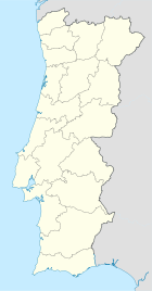
Basisdaten Region: Centro Unterregion: Dão-Lafões Distrikt: Guarda Concelho: Aguiar da Beira Koordinaten: 40° 46′ N, 7° 29′ W40.773333333333-7.49Koordinaten: 40° 46′ N, 7° 29′ W Einwohner: 272 (Stand: 2001) Fläche: 9,2 km² Bevölkerungsdichte: 30 Einwohner pro km² Eirado ist eine Gemeinde (Freguesia) im zentralportugiesischen Kreis Aguiar da Beira. In ihr leben 272 Einwohner (Stand: 2001).[1]
Bauwerke
- Capela de Nossa Senhora do Amparo
- Capela de Santo António
- Capela de São João Baptista
- Capela do Senhor do Castelinho
- Igreja de Nossa Senhora do Repouso
Einzelnachweise
- ↑ Daten zu Eirado (en). alea.pt. Abgerufen am 2. Mai 2011.
Weblinks
- Karte der Freguesia Eirado beim Instituto Geográfico do Exército
Freguesias im Concelho Aguiar da BeiraAguiar da Beira | Carapito | Cortiçada | Coruche | Dornelas | Eirado | Forninhos | Gradiz | Pena Verde | Pinheiro | Sequeiros | Souto de Aguiar da Beira | Valverde
Wikimedia Foundation.
Schlagen Sie auch in anderen Wörterbüchern nach:
Eirado — Saltar a navegación, búsqueda 40°46′24″N 7°29′24″O / 40.77333, 7.49 … Wikipedia Español
eirado — s. m. 1. Espaço descoberto, sobre uma casa, ou ao nível de um andar dela. 2. Terrado; terraço; eira … Dicionário da Língua Portuguesa
Eirado Do Pino — (Meaño,Испания) Категория отеля: Адрес: Quintáns, nº 8 Simes, 36968 Meaño, Испан … Каталог отелей
Hotel do Eirado — (Caldelas,Португалия) Категория отеля: 3 звездочный отель Адрес: Av. Afonso Manuel, 4720 249 … Каталог отелей
Эйраду — Район Эйраду Eirado Страна ПортугалияПортугалия … Википедия
Районы округа Гуарда — … Википедия
List of postal codes in Portugal — Aveiro districtMealhada municipality*3050 Antes *3050 Barcouço *3050 Casal Comba *3050 Luso *3050 Mealhada *3050 Pampilhosa *3050 Vacariça *3050 Ventosa do BairroMurtosa municipality*3870 Bunheiro *3870 Monte *3870 Murtosa *3870 TorreiraOliveira… … Wikipedia
Aguiar da Beira — Infobox Municipality pt official name = Aguiar da Beira image coat of arms = AGB.png District = Guarda Mayor name = Augusto Andrade Mayor party = PSD area total = 206.9 population total = 6,270 population density = 30 Parishes = 13 coor = 40º49 N … Wikipedia
Rio Dão — or river Dão is a Portuguese river that originates in the plateau regions of Trancoso Aguiar da Beira in the Eirado parish, Aguiar da Beira council, District of Guarda, and varies between 714 meters and 757 meters in elevation.It flows in a… … Wikipedia
Geography of Póvoa de Varzim — Póvoa de Varzimcoord|41|22|59|N|8|46|00|W|display=title, with an area of 82.06 square kilometres, lies between the Cávado and Ave rivers, or, from a wider perspective, halfway between the Minho and Douro rivers on the northern coast of Portugal… … Wikipedia


