- Fort Ransom State Park
-
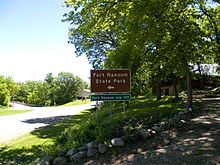 Zufahrt zum Fort Ransom State Park
Der Fort Ransom State Park ist ein State Park im Ransom County im US-Bundesstaat North Dakota. Der 359 Hektar große Park liegt nördlich des Ortes Fort Ransom im dicht bewaldeten Tal des Sheyenne River.
Inhaltsverzeichnis
Geschichte
Der Park wurde nach dem 1867 errichteten Fort der US-Armee benannt, dessen Überreste heute als State Historic Site etwa fünf Kilometer südlich des Parks liegen. Schon 1872 wurde das Fort wieder aufgegeben. In der Folgezeit siedelten vor allem Einwanderer aus Skandinavien in der Region. Der State Park wurde im Juli 1979 eröffnet.
Flora und Fauna
Das Parkgebiet bewahrt drei unterschiedliche Ökosysteme: die Laubwälder entlang des Sheyenne River, eine Hochgrasprärie und eine Mischgrasprärie. Im Park wachsen Amerikanische Ulmen, Rot-Eschen, Linden und Bur-Eichen, zusammen mit zahlreichen Straucharten und Präriegräsern.
Im Park kommen Weißwedelhirsche, Waschbären, Biber, Koyoten und Füchse vor. Zahlreiche Vogelarten können im Park beobachtet werden, darunter Helmspechte, Rotkehl-Hüttensänger, Kanadakleiber, Scharlachtangare und Präriebussarde, dazu zahlreiche Schmetterlingsarten. Im Sheyenne River kommen Glasaugenbarsche, Welse, Steinbarsche, Phoxinus und zahlreiche Muschelarten vor.
Touristische Anlagen
Der Park ist ganzjährig geöffnet und gilt als Natural and Scenic Area und gilt als offizieller Teil des Sheyenne River Valley National Scenic Byway[1]. Ein vier Kilometer langer Abschnitt des North Country National Scenic Trail verläuft durch den Park. Der Park verfügt über einen Campingplatz mit 30 Stellplätzen. Im Park können Kanus und Kajaks gemietet werden, um Wassersport auf dem Fluss zu betreiben. Durch den Park führen acht Kilometer Reitwege, für Gruppen stehen Pferdewiesen zur Verfügung. Im Winter kann das Parkgebiet mit Schneemobilen und auf über 10 km Loipen mit Langlaufski befahren werden.
Zwei Farmhäuser erinnern an die Pioniergeschichte der Region. Das Bjone House, erbaut 1879 von dem skandinavischen Einwanderer Nils Olson, war bis 1976 im Besitz seiner Nachfahren und dient jetzt als Besucherzentrum, in dem sich auch eine Ausstellung über die skandinavischen Traditionen der Region befindet. Ein weiteres Farmhaus, 1884 erbaut, erinnert an die Pionierzeit und dient als Kulisse für die jährlich im Juli und im September stattfindenden Sodbuster Days. An den Sodbuster Days demonstrieren Mitglieder der Fort Ransom Sodbusters Association Landwirtschaft und Landleben der Pionierzeit des späten 19. Jahrhunderts.
Weblinks
Einzelnachweise
- ↑ Sheyenne River Valley Scenic Byway. Abgerufen am 4. Juni 2011.
46.544444-97.936111Koordinaten: 46° 32′ 40″ N, 97° 56′ 10″ WKategorie:- State Park in North Dakota

Wikimedia Foundation.