River mile — A River mile is a measure of distance in miles along a river from its mouth. River mile numbers begin at zero and increase further upstream. The corresponding metric unit using kilometers is the River kilometer. They are analogous to vehicle… … Wikipedia
Fortescue River — Ophthalmia Stausee im Verlauf des Fortescue RiverVorlage:Infobox Fluss/KARTE fehlt … Deutsch Wikipedia
John Work House and Mill Site — Infobox nrhp | name =Work, John, House and Mill Site nrhp type = caption = Main Entrance to the property nearest city= Charlestown, Indiana area = built =1814 architect= Work, John architecture= Federal added = January 03, 2001 governing body =… … Wikipedia
Allegheny Islands State Park — Geobox Protected Area name = Allegheny Islands State Park native name = other name = other name1 = category local = Pennsylvania State Park category iucn = III image caption = The eastern part of Allegheny Islands State Park and the C.W. Bill… … Wikipedia
List of localities in Victoria (Australia) — Map of Local Government Areas in Victoria This is a list of locality names and populated place names in the state of Victoria, Australia, outside the Melbourne metropolitan area. It is organised by region from the south west of the state to the… … Wikipedia
Lighthouses in the United States — This United States has hundreds of lights as well as light towers, range lights, and pier head lights. Michigan has the most lights of any state with over 130. See also: Lightvessels in the United States, lightvessel, List of lighthouses and… … Wikipedia
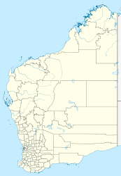
Protected areas of Western Australia — Western Australia is the second largest subnational entity in the world. It contains no fewer than 1224 separate Protected Areas with a total area of 170,610 km² (land area: 159,151 km² – 6.30% of the state’s area). Ninety eight of… … Wikipedia
Charlestown State Park — Charlestown State Park, Indiana, USA IUCN Category V (Protected Landscape/Seascape) … Wikipedia
Laguna de Santa Rosa — Geobox|River name = Laguna de Santa Rosa native name = other name = category = wetland complex etymology = Spanish nickname = image caption = Looking northeast across the Laguna de Santa Rosa with the Mayacamas Mountains in the background country … Wikipedia
Scouting in Indiana — Main Entrance to Tunnel Mill Scout Reservation Scouting in Indiana has a long history, from the 1910s to the present day, serving thousands of youth in programs that suit the environment in which they live. Contents 1 … Wikipedia

