Getchell Lake

Getchell Lake
Getchell Lake

Photo-request.svg

Bild gesucht 

BW

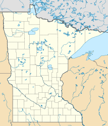
Geographische Lage Stearns County, Minnesota, USA
Zuflüsse Getchell Creek
Abfluss Getchell Creek → Sauk River → Mississippi River
Größere Städte in der Nähe New Munich
Daten
Koordinaten 45° 35′ 57″ N, 94° 40′ 58″ W45.5991315-94.6827862358Koordinaten: 45° 35′ 57″ N, 94° 40′ 58″ W
Getchell Lake (Minnesota)
Getchell Lake
Höhe über Meeresspiegel 358 m
Fläche 28 haf5

Der Getchell Lake (auch als Gatchell Lake[1] bezeichnet) ist ein See im Stearns County im US-Bundesstaat Minnesota. Er befindet sich 6,5 Kilometer südöstlich von New Munich und 1,5 Kilometer westlich der County Road 11 in einem Moorgebiet. Zufluss und Abfluss ist der Getchell Creek.[2] Seine Fläche beträgt ca. 28 Hektar (69 Acres), die Höhe über dem Meeresspiegel 358 Meter. 2,5 Kilometer östlich des Getchell Lake befindet sich der größere Sand Lake.[3][4]

Einzelnachweise

  1. U.S. Geological Survey. Geographic Names Phase I data compilation (1976-1981). 31-Dec-1981. Primarily from U.S. Geological Survey 1:24,000-scale topographic maps (or 1:25K, Puerto Rico 1:20K) and from U.S. Board on Geographic Names files. In some instances, from 1:62,500 scale or 1:250,000 scale maps
  2. Creeks & Lakes (Stearns County) (PDF-Datei (Karte))
  3. Getchell Lake im Geographic Names Information System des United States Geological Survey
  4. Getchell Lake - Stearns County Minnesota - LakePlace.com

Wikimedia Foundation.

Игры ⚽ Поможем написать реферат

Schlagen Sie auch in anderen Wörterbüchern nach:

  • Getchell — ist der Name von: Robert Getchell (* 1943), ein US amerikanischer Drehbuchautor und Universitätsprofessor Getchell Lake, ein See im US Bundesstaat Minnesota Diese Seite ist eine Begriffsklärung zur Unterscheidung mehrerer …   Deutsch Wikipedia

  • Mike Getchell — Personal information Full name Michael D. Getchell Date of birth May 6, 1963 ( …   Wikipedia

  • Meadow Lake Township, Barnes County, North Dakota — Meadow Lake Township is a civil township in Barnes County, North Dakota, USA. As of the 2000 census, its population was 93.[1] The township is located in Public Land Survey System Township 138N, Range 61W.[2] History Meadow Lake Township was… …   Wikipedia

  • Minnie Lake Township, Barnes County, North Dakota — Minnie Lake Township is a civil township in Barnes County, North Dakota, USA. As of the 2000 census, its population was 63.[1] References ^ U.S. Census Bureau. Census 2000. Census Demographic Profiles, Minnie Lake Township (PDF). CenStats… …   Wikipedia

  • Liste der Seen der Vereinigten Staaten — Inhaltsverzeichnis 1 Seen nach Gewässerart 1.1 Süßwasserseen 1.2 Salz bzw. Brackwasserseen 1.3 Stauseen …   Deutsch Wikipedia

  • National Register of Historic Places listings in Mendocino County, California — Map of all coordinates from Google Map of all coordinates from Bing …   Wikipedia

  • Marysville, Washington —   City   Flag …   Wikipedia

  • List of townships in North Dakota — This is an incomplete list of civil townships in North Dakota by county based on United States Geological Survey and U.S. Census data. See: List of counties in North Dakota, List of cities in North Dakota. NOTOC Adams County* Beisigl * Bucyrus *… …   Wikipedia

  • List of Minnesota streams — This is a list of streams in the state of Minnesota in the United StatesAlphabeticallyA*Ada Creek *Adley Creek *Ahmoo Creek *Alango Creek *Albrechts Creek *Alcohol Creek *Alfred Creek *Alvis Creek *Amenda Creek *Amity Creek **Amity Creek (East… …   Wikipedia

  • List of unincorporated communities in Washington — This is a list of unincorporated communities in the U.S. state of Washington which are not incorporated municipalities. Incorporated municipalities in the state are listed separately in a list of cities and list of towns. Contents 1 Census… …   Wikipedia

Share the article and excerpts

Direct link
Do a right-click on the link above
and select “Copy Link”