Glen Affric

Glen Affric
Glen Affric

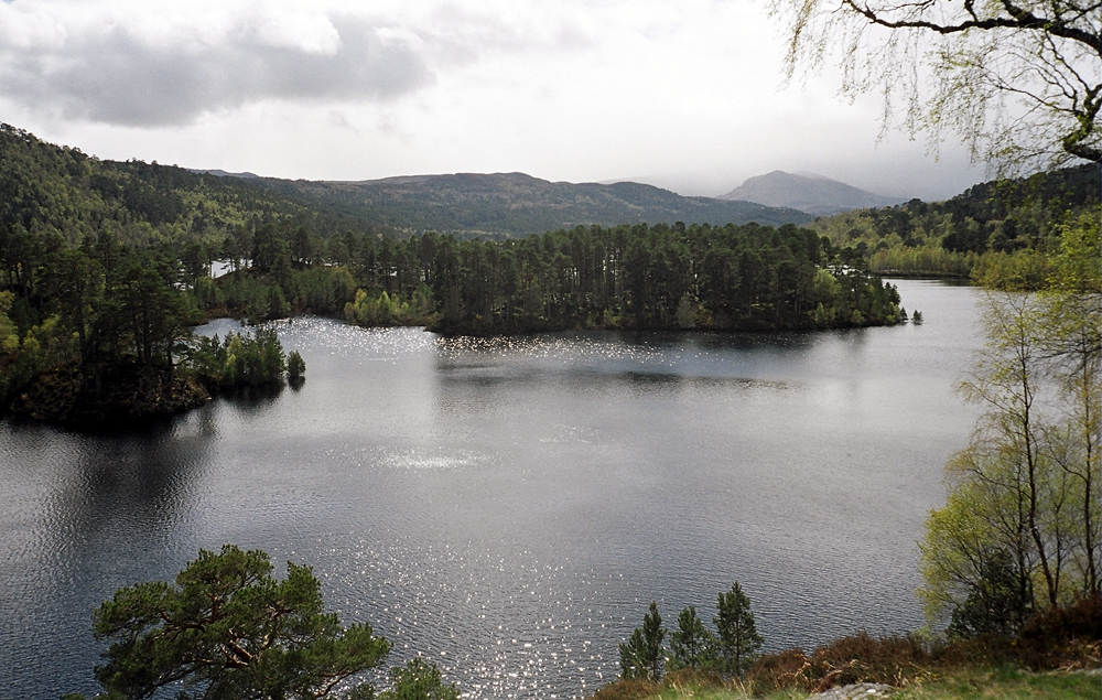
Der Glen Affric ist ein ca. 30 km langes Tal („Glen“) in den schottischen Northwest Highlands. Es befindet sich etwa 24 km westlich von Loch Ness. Durch das Tal fließt der Fluss Affric.

Das Tal gehörte ursprünglich zum Gebiet des Clans Chisholm.

Weblinks

 Commons: Glen Affric – Sammlung von Bildern, Videos und Audiodateien
57.235961111111-5.1532694444444

Wikimedia Foundation.

Игры ⚽ Поможем сделать НИР

Schlagen Sie auch in anderen Wörterbüchern nach:

  • Glen Affric — (Scottish Gaelic: Gleann Afaraig ) is a glen south west of the village of Cannich in the Highland region of Scotland, some 15 miles to the west of Loch Ness. The River Affric runs along its length, passing through Loch Affric and Loch Beinn a… …   Wikipedia

  • Glen Affric — 57° 14′ 09″ N 5° 09′ 12″ W / 57.23596, 5.15327 …   Wikipédia en Français

  • Glen Affric — Sp Ãfriko slėnis Ap Glen Affric angliškai Sp Gleñ Ãfrikas Ap Gleann Afraig geliškai (škotiškai) L D. Britanijoje (Škotijoje) …   Pasaulio vietovardžiai. Internetinė duomenų bazė

  • Dog Falls, Glen Affric — Dog Falls (Gaelic: Eas a Choin) is a series of waterfalls on the River Affric, in Glen Affric in the Highlands of Scotland. The falls are within the Glen Affric National Nature Reserve, managed by Forestry Commission Scotland. There are several… …   Wikipedia

  • Affric-Beauly hydro-electric power scheme — The Affric / Beauly hydro electric power scheme for the generation of hydro electric power is located in the western Highlands of Scotland. It is based around Glen Stratharrar, Glen Cannich and Glen Affric, and Strathglass further downstream.The… …   Wikipedia

  • Glen Strathfarrar — is a glen in the Highland region of Scotland, near Loch Ness. The River Farrar runs through the glen. [ [http://www.glenaffric.org/strathfarrar.html Glen Strathfarrar] . GlenAffric.org. Retrieved 13 March 2007.] The Glen is part of the Affric… …   Wikipedia

  • Loch Affric — Geographische Lage Highland, Schottland Zuflüsse Affric …   Deutsch Wikipedia

  • Mam Sodhail — seen from Càrn Eige, 1 km to the NE. Elevation 1,181 m (3 …   Wikipedia

  • Sgurr nan Ceathramhnan — Infobox Mountain Name = Sgurr nan Ceathreamhnan Photo = Sgurr nan Ceathreamhnan from Mam Sodhail.jpg Caption = Sgurr nan Ceathreamhnan from Mam Sodhail, 5 km to the NE. The Kintail hills are in the background Elevation = 1151 m (3776 ft) Location …   Wikipedia

  • Ciste Dhubh — seen from the Corbett Am Bàthach, three km to the south. Elevation …   Wikipedia

Share the article and excerpts

Direct link
Do a right-click on the link above
and select “Copy Link”