Gunung Rantekombola

Gunung Rantekombola
Gunung Rantekombola

Photo-request.svg

Bild gesucht 

BWf1

Höhe 3.455 m
Lage Sulawesi (Indonesien)
Geographische Lage 3° 21′ 0″ S, 120° 1′ 0″ O-3.35120.01666673455Koordinaten: 3° 21′ 0″ S, 120° 1′ 0″ O
Gunung Rantekombola (Sulawesi)
Gunung Rantekombola

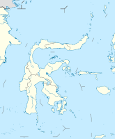
Der Rantekombola (Indonesisch: Bulu Rantekombola) ist der zweithöchste Berg auf Sulawesi und liegt in der Provinz Sulawesi Selatan. Es gibt allerdings Quellen, die ihn anstelle des nahegelegenen Gunung Rantemario als höchsten Berg der Insel bezeichnen.


Wikimedia Foundation.

Игры ⚽ Поможем сделать НИР

Schlagen Sie auch in anderen Wörterbüchern nach:

  • Rantemario — pd3pd5 Rantemario Bild gesucht  BWf1 Höhe …   Deutsch Wikipedia

  • List of Indonesia-related topics — This is a list of topics related to Indonesia. Those interested in the subject can monitor changes to the pages by clicking on Related changes ( alt k ) in the sidebar.This list can re read in conjunction with List of basic Indonesia topics… …   Wikipedia

  • Liste der Berge oder Erhebungen in Indonesien — Diese Liste zeigt der Höhe nach geordnet die höchsten Berge Indonesiens. Rang Gipfel Höhe Insel Gebirge/Massiv 1. Puncak Jaya (Carstensz Pyramide) 4.884 m Neuguinea Maokegebirge (Sudirman Range) 2. Puncak Trikora 4.750 m Neugu …   Deutsch Wikipedia

  • Mount Rantemario — Rantemario …   Wikipedia

Share the article and excerpts

Direct link
Do a right-click on the link above
and select “Copy Link”