Kaimanawa Range

Kaimanawa Range

p1f1p3p5

Kaimanawa Range
Lage Nordinsel (Neuseeland)
Kaimanawa Range (Neuseeland)
Kaimanawa Range
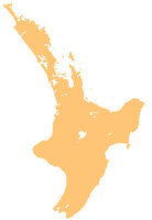
Koordinaten 39° 13′ S, 175° 55′ O-39.223175.921Koordinaten: 39° 13′ S, 175° 55′ O

Die Kaimanawa Range (oder Kaimanawa Ranges) liegen zentral auf der Nordinsel Neuseelands. Sie grenzen im Norden an die westlichen Teile der Kaweka Range und erstrecken sich vom Südende des Lake Taupo ca. 50 km bis zu den Ruahine Range im Süden.

Durch das Tongariro Vulkanplateau vom Regen abgeschirmt, ist der nördliche Bereich so arm an Niederschlag, dass die State Highway 1 dort „desert road“ und das Gebiet Rangipo Desert genannt wird.

Die weiter südlich gelegenen Gebiete der Kaimanawa Range sind weniger unwirtlich; große Teile der Landschaft befinden sich in Privatbesitz, was eher untypisch für neuseeländische Berglandschaften ist.

Weblinks


Wikimedia Foundation.

Игры ⚽ Поможем сделать НИР

Schlagen Sie auch in anderen Wörterbüchern nach:

  • Kaimanawa Range — The Kaimanawa Range of mountains (often known as the Kaimanawa Ranges ) is located in the central North Island of New Zealand. They extend for 50 kilometres in a northeast/southwest direction through largely uninhabited country to the south of… …   Wikipedia

  • Kaimanawa — The New Zealand Māori word Kaimanawa relates to two separate things:*The Kaimanawa Range of mountains, in the North Island *Kaimanawa horses, a feral horse found in the area …   Wikipedia

  • Kaimanawa horses — are a population of feral horses in New Zealand that are descended from domestic horses released in the 19th and 20th centuries. They are known for their hardiness and quiet temperament.HistoryThe Kaimanawa breed descended from domestic horses… …   Wikipedia

  • Montes Kaimanawa — Montes Kaimanawa …   Wikipedia Español

  • Moawhango River — Origin Kaimanawa Range Mouth Rangitikei River Basin countries New Zealand Length 62 kilometres (39 mi) The Moawhango River is a major river of the centre of …   Wikipedia

  • Mangamaire River — Origin Kaimanawa Range Mouth Rangitikei River Basin countries New Zealand Length 23 kilometres (14 mi) The Mangamaire River is a river of the centre of …   Wikipedia

  • Tongariro National Park — Infobox protected area name = Tongariro National Park iucn category = II caption = Map of New Zealand locator x = 185 locator y = 73 location = Ruapehu District, New Zealand nearest city = National Park, New Zealand lat degrees = 39 lat minutes …   Wikipedia

  • Huia — This article is about the extinct bird species. For other uses, see Huia (disambiguation). Huia A pair (male in front of female) Painting by J.G. Keulemans from W.L. Buller s A History of the Birds of New Zealand (1888) …   Wikipedia

  • Parque Nacional de Tongariro — Saltar a navegación, búsqueda Parque Nacional de Tongariro Categoría IUCN II (Parque nacional) Río Mahuia …   Wikipedia Español

  • Гуйя — †Гуйя Птица с изогнутым клювом на заднем плане взрослая самка, птица на переднем плане взрослый самец. Художник Й. Г. Кёлеманс, 1888 …   Википедия

Share the article and excerpts

Direct link
Do a right-click on the link above
and select “Copy Link”