Lintmill

Lintmill
Lintmill
Koordinaten 57° 41′ N, 2° 49′ W57.675833333333-2.8125Koordinaten: 57° 41′ N, 2° 49′ W
Lintmill (Schottland)
Lintmill
Lintmill
Verwaltung
Post town BUCKIE
Postleitzahlen­abschnitt AB56
Vorwahl 01542
Landesteil Scotland
Unitary authority Moray
Britisches Parlament Moray
Schottisches Parlament Moray
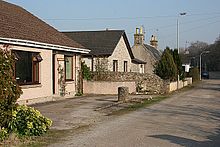
Straßenzug in Lintmill

Lintmill ist ein kleines Dorf, das direkt an der Ostgrenze der schottischen Unitary Authority Moray zu Aberdeenshire gelegen ist. Lintmill liegt am Bach Cullen Burn etwa 1,5 Kilometer südlich von Cullen und neun Kilometer östlich von Buckie.[1] Das Dorf ist über die etwa einen Kilometer nördlich verlaufende A98, die Fochabers mit Fraserburgh verbindet, an das Fernstraßennetz angeschlossen.

Ab 1825 war Lintmill Standort einer überregional bedeutenden Whiskybrennerei namens Tochineal. Diese wurde jedoch im Jahre 1871 zu Gunsten der Brennerei Inchgower in Buckie geschlossen.[2]

Einzelnachweise

  1. Eintrag im Gazetteer for Scotland
  2. Eintrag zur Tochineal-Brennerei auf lostdistillery.com

Wikimedia Foundation.

Игры ⚽ Поможем написать реферат

Schlagen Sie auch in anderen Wörterbüchern nach:

  • Buckie — infobox UK place country = Scotland official name= Buckie scots name= gaelic name= Bucaidh population= 8,059 [cite web|publisher=Scotland s Census Results Online|title =Comparative Population Profile: Buckie Locality |… …   Wikipedia

  • Neilston — Coordinates: 55°47′05″N 4°25′24″W / 55.784663°N 4.423396°W / 55.784663; 4.423396 …   Wikipedia

  • List of Sites of Special Scientific Interest in Berwickshire and Roxburgh — The following is a list of Sites of Special Scientific Interest in the Berwickshire and Roxburgh Area of Search. For other areas, see List of SSSIs by Area of Search.* Abbey St Bathans Woodlands * Adderstonlee Moss * Alemoor West Loch and Meadow… …   Wikipedia

  • Moray — Moireibh Verwaltungssitz Elgin Fläche 2.238 km² (8.) …   Deutsch Wikipedia

Share the article and excerpts

Direct link
Do a right-click on the link above
and select “Copy Link”