- Little Susitna River
-
Little Susitna River 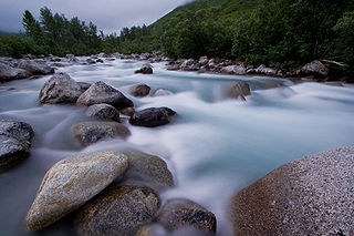
Daten Lage Alaska Quelle Mint-Gletscher, Talkeetna Mountains
61° 51′ 31″ N, 149° 3′ 48″ W61.858611-149.063333Mündung Cook Inlet 61.250833-150.288056Koordinaten: 61° 15′ 3″ N, 150° 17′ 17″ W
61° 15′ 3″ N, 150° 17′ 17″ W61.250833-150.288056Länge 180 km Einzugsgebiet 160 km² [1] Abflussmenge MQ: 5,8 m³/s [1] Gemeinden Fishhook, Meadow Lakes, Houston, Big Lake, Point MacKenzie Der Little Susitna River ist ein 180 km langer Fluss im Süden von Alaska. Er hat ein Einzugsgebiet von 160 km² und einen mittleren Abfluss von 5,8 m³/s (gemittelt über die Jahre 1948 bis 1996).
Er entspringt östlich des Hatcher Passes aus dem Mint-Gletscher in den Talkeetna Mountains, fließt südwestwärts und mündet westlich von Anchorage in das Cook Inlet.
Der George Parks Highway überquert den Little Susitna River bei Meile 69,5 und folgt dem Fluss für knapp zwei Kilometer. Gemeinden und Census-designated places am Fluss sind Fishhook, Meadow Lakes, Houston, Big Lake und Point MacKenzie
Weblinks
Einzelnachweise
Kategorien:- Fluss in Alaska
- Fluss in Nordamerika
- Matanuska-Susitna Borough

Wikimedia Foundation.