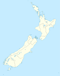
Manaia (Taranaki)

Manaia (Taranaki)
Manaia
Manaia (Neuseeland)
Manaia
Koordinaten 39° 33′ S, 174° 8′ O-39.550833333333174.125Koordinaten: 39° 33′ S, 174° 8′ O
Einwohner 927 (2006)
Region Taranaki
Distrikt South-Taranaki-Distrikt

Manaia ist ein Dorf im South-Taranaki-Distrikt in der Taranaki in Neuseeland. Opunake liegt 29 km nordwestlich, Hawera 13 km südöstlich, Kaponga 15 km nördlich. der State Highway 45 führt durch den Ort.[1][2] Manaia ist nach einem früheren Māorihäuptling der Region, Hukunui Manaia, benannt.

Der Ort hatte beim Zensus 2006 927 Einwohner, ein Rückgang von 24 gegenüber 2001.

Der Ort besitzt eine South Taranaki District Council LibraryPlus, eine Bücherei, die neben der Buchleihe verschiedene Verwaltungsleistungen und kostenlosen Internetzugang anbietet.

Geschichte

Manaja besitzt eine frühere Redoute, die um 1880 zu Friedenszeiten anstelle des Te Takahe durch den Parihaka-Häuptling Te Whiti o Rongomai erbaut wurde. Der 35 m hohe hölzerne Wachturm wurde durch einen Sturm zerstört und 1912 durch einen Betonturm ersetzt. Dieser und zwei originale Blockhäuser stehen heute inmitten eines Golfplatzes. Gräben umgaben Turm und Blockhäuser. Die Anlage konnte etwa 160 Verteidiger beherbergen.

Der 1905 eröffnete Golfplatz ist einer der ältesten in der Region Taranaki.

An der Straße von Manaia nach Hawera sind die Betonreste einer Mühle zu sehen. Diese sind Reste einer Mühle, die 1900 gebaut wurde, um eine hölzerne Mühle ersetzte, die 1882 von D. F. McVicar von der Sentry Hill flour mill aus New Plymouth gebaut worden war. Der Waiokura River trieb die Mühle über ein Wasserrad mit 4,6 m großes Wasserrad mit 11 kW Leistung an. Sie hatte 4 Stockwerke und war 11 m lang und 6 m breit. Das Gebäude ermöglichte die Lagerung von 15.000 Sack Mehl.

Die Bäckerei Yarrows ist seit 1923 der wichtigste Arbeitgeber.

Manaia hat eine Grundschule mit 2011 166 Schülern.[3] Sie wurde 1882 gegründet [4]. 2005 schloss die Tokaora School und fusionierte mit der Manaia School.[5]

Einzelnachweise

  1. Peter Dowling (Hrsg.): Reed New Zealand Atlas. Reed Books 2004, ISBN 0-7900-0952-8
  2. Roger Smith, GeographX: The Geographic Atlas of New Zealand. Robbie Burton 2005, ISBN 1-877333-20-4
  3. Schuldatenbank des Neuseeländischen Bindungministeriums
  4. Manaia School, Hawera & Normanby Star. 26 June 1882, S. 2. 
  5. Mergers, Closures and New Schools, January 2005 - December 2005 (XLS). Education Counts. Abgerufen am 31. Januar 2011.

Wikimedia Foundation.

Игры ⚽ Поможем решить контрольную работу

Schlagen Sie auch in anderen Wörterbüchern nach:

  • Manaia, Taranaki — For other uses, see Manaia. Manaia …   Wikipedia

  • Manaia — may refer to: Manaia (mythological creature), a bird headed mythological creature and symbol of protection in Māori mythology Manaia (Samoa), a tribal rank in Samoa held by the son of a chief Manaia (cultural group), a Māori cultural group in the …   Wikipedia

  • Manaia — bezeichnet: Manaia (Taranaki), einen Ort im South Taranaki Distrikt in Neuseeland Manaia (Waikato), ein Ort auf der Coromandel Halbinsel in Neuseeland Manaia (Māori), ein Häuptling in der Mythologie der Māori Mount Manaia, ein Berg auf der… …   Deutsch Wikipedia

  • Manaia (disambiguation) — Manaia may refer to: *Manaia, a town in the South Taranaki District of New Zealand *Manaia, Coromandel, a town on the Coromandel Peninsula of New Zealand *Manaia (mythology), a chief of Hawaiki in Māori mythology *Mount Manaia is a landmark on… …   Wikipedia

  • Taranaki Rugby Football Union — Rugby team teamname = Taranaki Rugby Football Union nickname = Amber and Blacks founded = 1885 region = Taranaki ground = Yarrow Stadium capacity = 25,000 coach = flagicon|New Zealand Adrian Kennedy captain = flagicon|New Zealand Tony Penn chief… …   Wikipedia

  • Second Taranaki War — Infobox Military Conflict conflict = Second Taranaki War partof = New Zealand land wars caption = date = April/May 1863 to November 1866 place = Taranaki territory = result = Indecisive status = combatant1 = New Zealand Government combatant2 =… …   Wikipedia

  • South-Taranaki-Distrikt — South Taranaki District Council Karte Basisdaten Region …   Deutsch Wikipedia

  • South Taranaki District — District de South Taranaki Le district de South Taranaki est situé dans la région de Taranaki, dans l île du Nord de la Nouvelle Zélande. Il abrite la ville de Hawera (11 000 habitants) et les villages de Manaia, Opunake, Patea, Eltham et… …   Wikipédia en Français

  • District de South Taranaki — Le district de South Taranaki est situé dans la région de Taranaki, dans l île du Nord de la Nouvelle Zélande. Il abrite la ville de Hawera (11 000 habitants) et les villages de Manaia, Opunake, Patea, Eltham et Waverley (tous de moins de… …   Wikipédia en Français

  • South Taranaki District — South Taranaki is a political district on the west coast of New Zealand s North Island that contains the towns of Hawera, Manaia, Opunake, Patea, Eltham, and Waverley. The District has a land area of 3,575.46 km² (1,380.49 sq mi) and a 2006… …   Wikipedia

Share the article and excerpts

Direct link
Do a right-click on the link above
and select “Copy Link”