- McNeil River
-
McNeil River 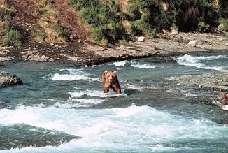
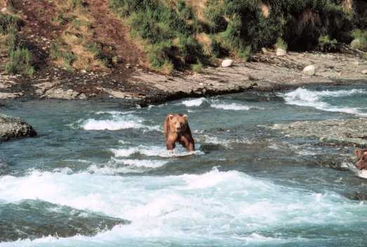
Braunbär im McNeil River State Game Sanctuary
Daten Lage Alaska Quelle Aleutenkette
58° 55′ 48″ N, 154° 40′ 4″ W58.93-154.667778Mündung McNeil Cove, Cook Inlet 59.125-154.246944Koordinaten: 59° 7′ 30″ N, 154° 14′ 49″ W
59° 7′ 30″ N, 154° 14′ 49″ W59.125-154.246944Länge 55 km Der McNeil River ist ein etwa 55 km langer Fluss auf der Alaska-Halbinsel.
Er entspringt aus einem Gletscher in der Aleutenkette, fließt nordostwärts und mündet in die McNeil Cove, eine Bucht des Cook Inlets.
Der McNeil River liegt vollständig im McNeil River State Game Sanctuary, einem als National Natural Landmark ausgewiesenen, vom Katmai-Nationalpark umgebenen Schutzgebiet. Die vielen niedrigen, seichten Wasserfälle des Flusses bieten Braunbären gute Lachsfang-Gelegenheiten.
Benannt ist der Fluss nach Charlie McNeil, einem Farmer aus der Region.
Weblinks
Kategorien:- Fluss in Alaska
- Fluss in Nordamerika
Wikimedia Foundation.