Migny

Migny
Migny
Migny (Frankreich)
Migny
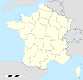
Region Centre
Département Département Indre
Arrondissement Issoudun
Kanton Issoudun-Nord
Gemeindeverband Communauté de communes du Pays d’Issoudun.
Koordinaten 47° 2′ N, 2° 4′ O47.0258333333332.0672222222222Koordinaten: 47° 2′ N, 2° 4′ O
Höhe 112–153 m
Fläche 13,35 km²
Einwohner 120 (1. Jan. 2008)
Bevölkerungsdichte 9 Einw./km²
Postleitzahl 36260
INSEE-Code
.

Migny ist eine französische Gemeinde mit 120 Einwohnern (Stand 1. Januar 2008) im Département Indre in der Region Centre; sie gehört zum Arrondissement Issoudun und zum Kanton Issoudun-Nord.

Nachbargemeinden von Migny sind Diou im Norden, Lazenay im Nordosten, Poisieux im Osten, Saint-Georges-sur-Arnon im Süden und Sainte-Lizaigne im Westen

Bevölkerungsentwicklung

Jahr 1962 1968 1975 1982 1990 1999 2008
Einwohner 124 94 64 86 78 99 120

Wikimedia Foundation.

Игры ⚽ Нужна курсовая?

Schlagen Sie auch in anderen Wörterbüchern nach:

  • Migny — Migny …   Wikipedia

  • Migny — País …   Wikipedia Español

  • Migny — 47° 01′ 33″ N 2° 04′ 02″ E / 47.0258333333, 2.06722222222 …   Wikipédia en Français

  • Migny Hotel Paris (Paris) — Migny Hotel Paris country: France, city: Paris (Grands Boulevards) Migny Hotel Paris Location The hotel is located in the heart of the 9th district, close to the foot of the Montmartre Hill, in the area of the New Athena.There is a metro station… …   International hotels

  • Migny River — The Migny River is a river on the island of Saint Lucia. Categories: Rivers of Saint LuciaSaint Lucia geography stubs …   Wikipedia

  • Hotel Migny Opéra Montmartre — (Париж,Франция) Категория отеля: 3 звездочный отель Адрес: 13 Rue Victo …   Каталог отелей

  • Diou (Indre) — Pour les articles homonymes, voir Diou. 47° 02′ 49″ N 2° 01′ 37″ E …   Wikipédia en Français

  • Routes de l'Indre — Réseau routier de l Indre Le réseau routier de l Indre est le réseau de routes principales et secondaires du département de l Indre. Sommaire 1 Histoire 1.1 Cartographie 2 Le réseau Aujourd hui 3 …   Wikipédia en Français

  • Routes de l'indre — Réseau routier de l Indre Le réseau routier de l Indre est le réseau de routes principales et secondaires du département de l Indre. Sommaire 1 Histoire 1.1 Cartographie 2 Le réseau Aujourd hui 3 …   Wikipédia en Français

  • Sainte-Lizaigne — 47° 00′ 28″ N 2° 01′ 25″ E / 47.0077777778, 2.02361111111 …   Wikipédia en Français

Share the article and excerpts

Direct link
Do a right-click on the link above
and select “Copy Link”