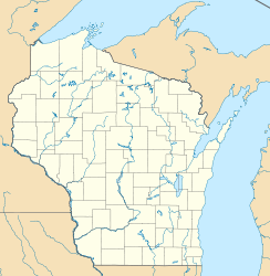
Mill Pond Lake (Iron River)
Schlagen Sie auch in anderen Wörterbüchern nach:
Mill Pond Lake — ist der Name dreier Seen in den Vereinigten Staaten: Mill Pond Lake (Iron River), im Bayfield County, im US Bundesstaat Wisconsin Mill Pond Lake (Long Lake Branch), im Bayfield County, im US Bundesstaat Wisconsin Mill Pond Lake (Telephone Creek) … Deutsch Wikipedia
River Poulter — River The ford at Crookford, where a track crosses the Poulter … Wikipedia
River Len — For an explanation of the various pieces of machinery mentioned, see Mill machinery. Len River Kent rivers, showing the Len … Wikipedia
River Len, Kent — Geobox|River name = Len native name = other name = other name1 = image size = 250px image caption = Kent rivers, showing the Len. etymology = country = England country1 = state = state1 = region = Kent region1 = district = Maidstone district1 =… … Wikipedia
River Beult — Infobox River river name = River Beult image size = caption = River Beult at Yalding origin = several sources west of AshfordTQ 980 390 Coord|51.115933|0.830014|display=inline|format=dms mouth = River Medway at YaldingTQ 693 503 Coord|51.226666|0 … Wikipedia
River Eden, Kent — Geobox|River name = Eden native name = other name = Broadmead Water (section) other name1 = image size = 300px image caption = Rivers in Kent etymology = country = England country1 = state = state1 = region = Kent region1 = district = district1 … Wikipedia
Lake Sunapee — Infobox lake lake name = Lake Sunapee image lake = Sunapee islands.jpg caption lake = A view between Great Island and Little Island image bathymetry = caption bathymetry = location = Sullivan County and Merrimack County, New Hampshire coords =… … Wikipedia
River Teise — Infobox River | river name = River Teise caption = Lesser Teise nearing the River Medway near Yalding (Twyford Bridge) in the distance) origin = Dunorlan Park in Tunbridge Wells mouth = Major stream River Beult at Hunton, minor stream River… … Wikipedia
List of mills in Fall River, Massachusetts — The city of Fall River, Massachusetts once had over 100 cotton textile mills [1] and was the leading cotton textile center in the United States during the late 19th century and early 20th century. [2] There are currently approximately 63 mills… … Wikipedia
Neponset River — with Granite Avenue in background Basin countries United States Length 29 mi (47 … Wikipedia

