Nokomai

Nokomai

p1

Nokomai
Nokomai (Neuseeland)
Nokomai
Koordinaten 45° 30′ S, 168° 40′ O-45.496552777778168.67316944444Koordinaten: 45° 30′ S, 168° 40′ O
Region Southland
Distrikt Southland-Distrikt

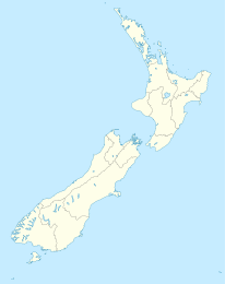
Nolomai ist ein heute landwirtschaftlich geprägter, kleiner Ort im Southland-Distrikt in der Region Southland auf der Südinsel Neuseelands. Er liegt in 298 m Höhe am hier Garston Athol Highway genannten State Highway 6. Der Ort ist über diese Straße mit Athol im Südwesten und Garston unmittelbar nördlich verbunden. Westlich der Siedlung verläuft der Mataura River.

In Nokomai befand sich ein bedeutender Goldtagebau, in dem unter einer 38 m hohen Abraumschicht eine 2 m starke goldführende Schicht mit einem Goldgehalt von reichlich einem Gramm pro Tonne abgebaut wurde. Der Tagebau wurde mittlerweile aufgegeben und rekultiviert.

Quellen


Wikimedia Foundation.

Игры ⚽ Поможем решить контрольную работу

Schlagen Sie auch in anderen Wörterbüchern nach:

  • Nokomai River — Basin countries New Zealand The Nokomai River is a river in New Zealand, a tributary of the Mataura River. See also List of rivers of New Zealand References …   Wikipedia

  • Central Otago Gold Rush — …   Wikipedia

  • List of rivers of New Zealand — This is a list of all waterways named as rivers in New Zealand. In a small number of cases, which have not been fully indexed here, there are multiple rivers bearing the same name; in these cases the notation (#) indicates the number of rivers… …   Wikipedia

  • Kingston Branch, New Zealand — Infobox rail line name = Kingston Branch color = logo width = image width = caption = type = regional rail system = New Zealand Government Railways Department status = Closed (Makarewa to Fairlight) locale = Southland, New Zealand start =… …   Wikipedia

  • History of Otago — The history of Otago in New Zealand tells the story of human settlement of one of the more isolated outliers of the inhabited earth. Archaic Māori period The precise date at which the first inhabitants of New Zealand reached Otago and the extreme …   Wikipedia

  • Archaeological Evidence of Gender in Central Otago Mining Communities — During the 19th Century in Central Otago New Zealand, the discovery of gold encouraged many prospectors from around the world and New Zealand to search for gold in Central Otago’s rivers, fields and gully’s. Prospectors, both men and women, young …   Wikipedia

  • Liste der Flüsse in Neuseeland — Die Liste der Flüsse in Neuseeland gibt eine Übersicht über alle permanent wasserführenden Flüsse im Staat Neuseeland: Inhaltsverzeichnis A B C D E F G H I J K L M N O P Q R S T U V W X Y Z …   Deutsch Wikipedia

  • Liste des cours d'eau de Nouvelle-Zélande — Liste des cours d eau de Nouvelle Zélande. Pour un petit nombre de cas, qui n a pas été pris intégralement en compte ici, il existe de multiples rivières portant un nom identique. Dans ce cas, la notation (#) indique le nombre de rivières… …   Wikipédia en Français

  • Liste des rivières de Nouvelle-Zélande — Liste des cours d eau de Nouvelle Zélande Liste des cours d eau de Nouvelle Zélande. Pour un petit nombre de cas, qui n a pas été pris intégralement en compte ici, il existe de multiples rivières portant un nom identique. Dans ce cas, la notation …   Wikipédia en Français

  • Athol (Neuseeland) — p1 Athol …   Deutsch Wikipedia

Share the article and excerpts

Direct link
Do a right-click on the link above
and select “Copy Link”