Oneata

Oneata

Vorlage:Infobox Insel/Wartung/Bild fehlt

Oneata
Gewässer Pazifischer Ozean
Inselgruppe Lau-Inseln
Geographische Lage 18° 26′ 24″ S, 178° 28′ 33″ W-18.44-178.4758333333349Koordinaten: 18° 26′ 24″ S, 178° 28′ 33″ W
Oneata (Fidschi)
Oneata
Länge 4,5 km
Breite 1,7 km
Fläche 5 km²
Höchste Erhebung 49 m
Hauptort Dakuiloa

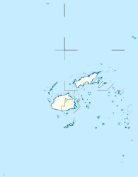
Oneata ist eine Insel im Osten des Lau-Archipels im Pazifischen Ozean. Politisch gehört sie zur Eastern Division des Inselstaates Fidschi.

Geographie

Oneata liegt rund 25 km nordnordöstlich von Moce sowie rund 40 km südöstlich von Lakeba, der Hauptinsel des Archipels. Auf halber Strecke nach Lakeba liegt die kleine und unbewohnte Insel Aiwa, auf halber Strecke nach Moce – in der Oneata Passage – das ringförmige und stets überflutete Korallenriff Cakau Lekaleka. Oneata ist 4,5 km lang und bis zu 1,7 km breit; ihre Fläche lässt sich zu rund 5 km² abschätzen. Die Insel ist weitläufig von einem Korallenriff umsäumt, das im Norden vier Passagen aufweist und Einfahrten in die Lagune ermöglicht. Sie ist dicht bewachsen und erreicht eine Höhe von 49 m über dem Meer.[1] Innerhalb der Lagune, 750 m östlich von Oneata, liegt die kleine, unbewohnte und bis 43 m hohe Insel Loa (bei 18° 26′ S, 178° 27′ W-18.430419444444-178.44334166667). Oneata bildet einen der 13 traditionellen Distrikte (Tikina) der Lau-Provinz[2] und hat zwei Dörfer (Koro), Waiqori im Osten und Dakuiloa im Westen der Insel.[3]

Weblinks

Einzelnachweise

  1. Sailing Directions (enroute), Pub. 126, Pacific Ocean (PDF; englisch)
  2. House of Chiefs - Lau (englisch)
  3. Eintrag bei geonames.org (englisch)

Wikimedia Foundation.

Игры ⚽ Нужен реферат?

Schlagen Sie auch in anderen Wörterbüchern nach:

  • Ionel Augustin —  Ionel Augustin Spielerinformationen Voller Name Ionel Augustin Geburtstag 11. Oktober 1955 Geburtsort Bukarest, Rumänien Position Stürmer …   Deutsch Wikipedia

  • Lauanische Sprache — Lauanisch (Lau) Gesprochen in Fidschi (Inseln Lau, Nayau, Lakeba, Oneata, Moce, Komo, Namuka, Kabara, Vulaga, Ogea und Vatoa) Sprecher 16.000 (1981)[1] Linguistische Klassifikation Austronesian …   Deutsch Wikipedia

  • Fijian language — Fijian Na vosa vaka Viti Spoken in  Fiji Region Spoken as first language on …   Wikipedia

  • List of cities in Tonga — The following list gives all islands and cities (villages and hamlets) in Tonga in alphabetical order with many local areas and (poetical) nicknames as well.Layout(An overview of the adopted layout method for each archipelago main group.… …   Wikipedia

  • Lakemba, New South Wales — Infobox Australian Place | type = suburb name = Lakemba city = Sydney state = NSW caption = Haldon Street, Lakemba lga = City of Canterbury postcode = 2195 est = pop = area = propval = stategov = Lakemba fedgov = Watson near nw = Mount Lewis near …   Wikipedia

  • Mago Island — Coordinates: 17°26′S 179°09′W / 17.433°S 179.15°W / 17.433; 179.15 …   Wikipedia

  • Vuanirewa — Nobility of Fiji Titles Adi Bulou Ro Roko Ratu Institutions Great Council of Chiefs Chairman, Great Council of Chiefs House of Chiefs Confederacies: Burebasaga Kubuna Tovata Rotuman Traditional Leadership Gagaja …   Wikipedia

  • Tui Nayau — is the title held by the Paramount Chief of the Lau Islands in Fiji and is synonymous with the title holders over lordship of these islands. When translated Tui Nayau means Lord of Nayau, an island north of Lakeba, the latter accepted by many to… …   Wikipedia

  • Eastern Division, Fiji — The Eastern Division of Fiji is one of Fiji s four divisions. It consists of the four provinces, Kadavu, Lau, Lomaiviti and Rotuma.The capital of the division is Levuka, on the Ovalau island. Other islands in the division include Kadavu, Gau,… …   Wikipedia

  • Cicia —   Island   …   Wikipedia

Share the article and excerpts

Direct link
Do a right-click on the link above
and select “Copy Link”