Rakaia

Rakaia
Rakaia
Rakaia (Neuseeland)
Rakaia
Koordinaten 43° 45′ S, 172° 1′ O-43.75172.01666666667Koordinaten: 43° 45′ S, 172° 1′ O
Einwohner 1.068 (2006)
Region Canterbury
Distrikt Ashburton-Distrikt

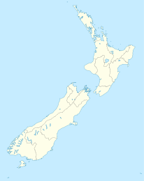
Rakaia ist eine Kleinstadt im Ashburton-Distrikt in der Region Canterbury auf der Südinsel Neuseelands. Sie befindet sich nahe dem Südufer des Rakaia River in der Ebene der Canterbury Plains am State Highway 1 und der Eisenbahnhauptlinie der Südinsel, der Main South Line. Unmittelbar nördlich befindet sich die längste Straßen- und die längste Eisenbahnbrücke des Landes, die beide das breite Schotterbett des Rakaia überquert, der hier als Braided River ein breites Flussbett nutzt. Beide Brücken sind etwa 1750 Meter lang. Rakaia war von 1880 bis zur Schließung 1976 auch die Stelle, an der die Nebenbahn Methven Branch nach Methven von der Main South Line abzweigte.

Im Ort ist ein großer, springender Lachs aus Glasfiber aufgestellt. Dieser weist auf die Bedeutung des Flusses für das Lachsangeln und Jetbootfahren hin.

Der Ort besitzt einen 18-Loch-Golfplatz. Beim Zensus 2006 betrug die Bevölkerung 1068 Einwohner.[1]

Weblinks

Einzelnachweise


Wikimedia Foundation.

Игры ⚽ Нужно сделать НИР?

Schlagen Sie auch in anderen Wörterbüchern nach:

  • Rakaia — RakaiaUrban AreaPopulation1,080 (2006 est.)Territorial AuthorityNameAshburton District CouncilPopulation27,600 (2006 est.)Extent Pacific Ocean to the Southern Alps, and the Rangitata River to the Rakaia River, including the towns of Methven,… …   Wikipedia

  • Rakaia — Rakaia …   Wikipédia en Français

  • Rakaia — Original name in latin Rakaia Name in other language South Rakaia State code NZ Continent/City Pacific/Auckland longitude 43.75 latitude 172.01667 altitude 118 Population 1043 Date 2011 08 01 …   Cities with a population over 1000 database

  • Rakaia (New Zealand electorate) — Rakaia is a New Zealand Parliamentary electorate.It is currently held by Brian Connell MP [ [http://www.parliament.nz/en NZ/MPP/MPs/MPs/f/f/f/48MP78061 Connell Brian.htm New Zealand Parliament Brian Connell MP] ] .Population CentresThe electorate …   Wikipedia

  • Rakaia River — The Rakaia River is in the Canterbury Plains in New Zealand s South Island. [ [http://www.linz.govt.nz/apps/placenames/index.html?p=20604 Rakaia River] , Place Name Detail, New Zealand Geographic Placenames Database, Land Information New Zealand… …   Wikipedia

  • Rakaia River — Flusssystem des Rakaia River Rakaia River vom Mount Hutt aus gesehen …   Deutsch Wikipedia

  • Rakaia Gorge — The Rakaia Gorge is located on the Rakaia River in inland Canterbury in New Zealand s South Island.Like its neighbour, the Waimakariri River, the Rakaia runs through wide shingle beds for much of its length, but is forced through a narrow canyon… …   Wikipedia

  • Rakaia River — River, eastern central South Island, New Zealand. Rising in the glaciers of the Southern Alps, it flows east and southeast for 90 mi (145 km) before entering Canterbury Bight of the Pacific Ocean through a delta west of Banks Peninsula. * * * ▪… …   Universalium

  • Rakaia — /rəˈkaɪə/ (say ruh kuyuh) noun a river in NZ, in the South Island, flowing south east to the Canterbury Bight in the Pacific Ocean. 145 km …  

  • Rakaia, río — Río del centro este de la isla del Sur en Nueva Zelanda. Nace en los glaciares de los Alpes meridionales; fluye primero hacia el este y luego hacia el sudeste a lo largo de 145 km (90 mi) antes de desembocar en la bahía de Canterbury, en el… …   Enciclopedia Universal

Share the article and excerpts

Direct link
Do a right-click on the link above
and select “Copy Link”