Rhos-Fawr (Powys)

Rhos-Fawr (Powys)
Rhos-Fawr (Great Rhos)
Gipfelplateau

Gipfelplateau

Höhe 660 m
Lage County Powys, Wales
Geographische Lage 52° 16′ 2″ N, 3° 11′ 59″ W52.2671-3.1998660Koordinaten: 52° 16′ 2″ N, 3° 11′ 59″ W
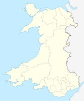
Rhos-Fawr (Powys) (Wales)
Rhos-Fawr (Powys)
Typ Bergplateau
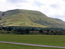
Rhos-Fawr und Black Mountains
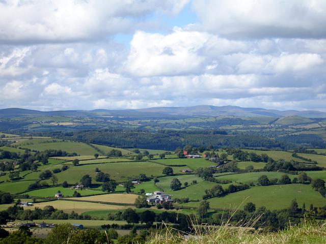
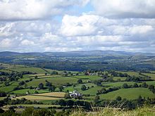
Blick vom Gipfel nach Norden

Der Rhos-Fawr (Great Rhos) ist ein Berg im County Powys in Wales, er ist die höchste Erhebung des Radnor Forest und Teil der Cambrian Mountains.

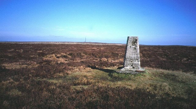
Der Gipfel steigt aus einer mit Heidekraut bewachsenen Hochebene empor. Seine Nebengipfel sind Black Mixen (walisisch Micsen Du), auf dem sich ein Sendemast befindet, der Drygarn Fawr und der Gorllwyn. Der Radnor Forest (Fforest Faesyfed) ist ein bewaldetes Jagdgebiet, aus dem das Rhos-Fawr-Bergland hervorragt.

Im Süden des Rhos-Fawr liegen die Black Mountains.

Legende

Nach einer lokalen Sage bauten die Einheimischen vier Kirchen rund um den Radnor Forest, um den letzten noch in Wales lebenden Drachen zu bannen, der hier schlafen soll. Die Kirchennamen waren Llanfihangel Cefnllys, Llanfihangel Rhydithon, Llanfihangel Nant Melan und Llanfihangel Cascob, alle dem Erzengel Michael dem Drachentöter (walisisch Mihangel) geweiht. Wenn auch nur eine der Kirchen zerstört wird, dann erwacht der Drache wieder und verwüstet das Land.

Weblinks


Wikimedia Foundation.

Игры ⚽ Нужно решить контрольную?

Schlagen Sie auch in anderen Wörterbüchern nach:

  • Rhos-fawr (Gwynedd) — Rhos fawr …   Deutsch Wikipedia

  • Drygarn Fawr — Eastern approach to Drygarn Fawr Elevation 645 m (2,116 ft) …   Wikipedia

  • Gwynedd in the High Middle Ages — is a period in the History of Wales spanning the 11th, 12th, and 13th centuries (AD 1000 ndash;1300). The High Middle Ages were preceded by the Early Middle Ages and followed by the Late Middle Ages. Gwynedd is located in the north of… …   Wikipedia

  • Kingdom of Gwynedd — Infobox Former Country native name = Teyrnas Gwynedd conventional long name = Kingdom of GwyneddRef|1 common name = Gwynedd |continent = Europe region = British Isles country = Wales era = Middle Ages government type = Monarchy |event start =… …   Wikipedia

  • Radnor Forest — Infobox Mountain | Name = Radnor Forest Rhos Fawr / Great Rhos Elevation = 660 m (2,165 ft) Location = Powys, WAL Photo = Great Rhos.jpg Range = Cambrian Mountains Prominence = 373 m Parent peak = Plynlimon Grid ref UK = SO182639 Topographic OS… …   Wikipedia

  • List of communities in Wales — This is a list of communities in Wales sorted by principal area. The community is the lowest tier of local government in Wales and is usually represented by a community council. Contents 1 Blaenau Gwent 2 Bridgend 3 Caerphilly …   Wikipedia

  • Gwladus Ddu — Gwladus Ddu, („Gwladus die Dunkle ), mit vollem Namen Gwladus ferch Llywelyn (Gwladus, Tochter des Llywelyn) (* um 1195 in Gwynedd, Wales; † 1251 in Windsor (Berkshire)) war eine walisische Prinzessin keltischer Herkunft, deren Leben durch den… …   Deutsch Wikipedia

  • Criccieth — Coordinates: 52°55′01″N 4°14′11″W / 52.91697°N 4.23626°W / 52.91697; 4.23626 …   Wikipedia

  • Carmarthenshire — Not to be confused with Caernarfonshire. County of Carmarthenshire Sir Gaerfyrddin Geography Area Total  % Water …   Wikipedia

  • Gruffydd ap Cynan — (also spelled Gryffydd ap Cynan) (c. 1055 ndash; 1137) was a King of Gwynedd. In the course of a long and eventful life, he became a key figure in Welsh resistance to Norman rule, and was remembered as King of all Wales. As a descendant of Rhodri …   Wikipedia

Share the article and excerpts

Direct link
Do a right-click on the link above
and select “Copy Link”