- Taftan
-
Taftan 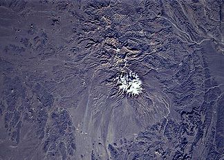
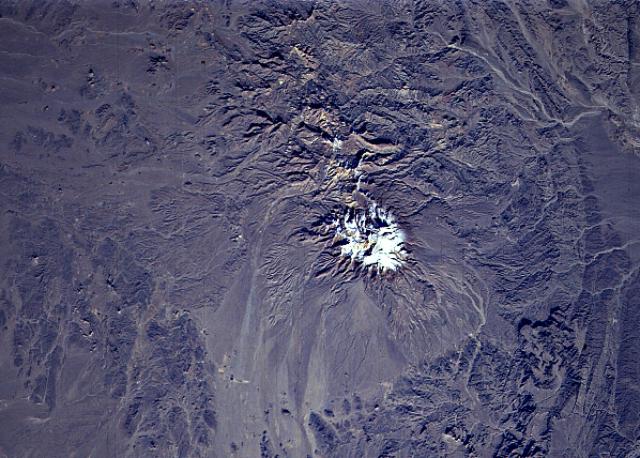
Satellitenbild der NASA
Höhe 3.940 m Lage Sistan und Belutschistan, Iran Geographische Lage 28° 36′ 0″ N, 61° 8′ 0″ O28.661.1333333333333940Koordinaten: 28° 36′ 0″ N, 61° 8′ 0″ O 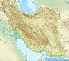

Typ Schichtvulkan Letzte Eruption 25. April 1993 Taftan (persisch تفتان Taftân, ‚Der Ort der Hitze‘) ist ein aktiver Schichtvulkan im Südosten Irans in der Provinz Sistan und Belutschistan. Mit nahezu 4000 m über dem Meeresspiegel ist es einer der höchsten Berge im Südosten Irans. Die nächstliegende Stadt ist Khash. Der höchste Gipfel trägt den Namen Cheheltan. Es treten verschiedene Gase aus, darunter Wasserdampf, Schwefelsäure, Schwefeldioxid, Schwefelwasserstoff und Kohlenstoffdioxid.[1]
Nach Angaben des Global Volcanism Programs entstehen hochaktive schwefelbedeckte Fumarolen auf dem südöstlichen Gipfel. Im Januar 1902 wurde berichtet, dass der Vulkan über mehrere Tage sehr starken Rauch ausstieß. 1993 wurde ein Lava-Fluss gemeldet. Möglicherweise handelt es sich aber um geschmolzenen Schwefel, der mit Lava verwechselt wurde.
Siehe auch
Weblinks
- Taftan im Global Volcanism Program der Smithsonian Institution (englisch)
Einzelnachweise
- ↑ The book of Iran: a survey of the geography of Iran - Kiyānoosh Kiyāni Haftlang, Kiyānūsh Kiyānī Haft Lang, Āzitā Rajabi - ISBN 9649449132
Kategorien:- Dreitausender
- Schichtvulkan
- Berg in Asien
- Berg im Iran
Wikimedia Foundation.