Teyssières

Teyssières
Teyssières
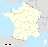
Teyssières (Frankreich)
Teyssières
Region Rhône-Alpes
Département Drôme
Arrondissement Nyons
Kanton Dieulefit
Gemeindeverband Communauté de communes du Pays de Dieulefit.
Koordinaten 44° 28′ N, 5° 9′ O44.4622222222225.1466666666667Koordinaten: 44° 28′ N, 5° 9′ O
Höhe 498–1.325 m
Fläche 28,09 km²
Einwohner 86 (1. Jan. 2008)
Bevölkerungsdichte 3 Einw./km²
Postleitzahl 26220
INSEE-Code
.

Teyssières ist eine französische Gemeinde mit 86 Einwohnern (Stand 1. Januar 2008) im Département Drôme in der Region Rhône-Alpes; sie gehört zum Arrondissement Nyons und zum Kanton Dieulefit.

Nachbargemeinden von Teyssières sind Montjoux im Nordwesten, Vesc im Nordosten, Valouse im Osten, Saint-Ferréol-Trente-Pas im Südosten, Condorcet, Aubres und Ventarol im Süden sowie Rousset-les Vignes und La Pègue im Westen.

Bevölkerungsentwicklung

Jahr 1962 1968 1975 1982 1990 1999 2007
Einwohner 106 77 71 58 69 64 89

Sehenswürdigkeiten


Wikimedia Foundation.

Игры ⚽ Поможем написать курсовую

Schlagen Sie auch in anderen Wörterbüchern nach:

  • Teyssieres — Teyssières Teyssières Administration Pays France Région Rhône Alpes Département Drôme Arrondissement Nyons Canton Dieulefit …   Wikipédia en Français

  • Teyssières — País …   Wikipedia Español

  • Teyssières — 44° 27′ 44″ N 5° 08′ 48″ E / 44.4622222222, 5.14666666667 …   Wikipédia en Français

  • Teyssières — Infobox Commune de France nomcommune=Teyssières région=Rhône Alpes département=Drôme arrondissement=Nyons canton=Dieulefit insee=26350 cp=26220 maire=Yves Monnier mandat=2001 2008 intercomm=Pays de Dieulefit longitude=5.146 latitude=44.462 alt… …   Wikipedia

  • Holiday Home Mazan Chemin Des Teyssiéres II — (Мазан,Франция) Категория отеля: Адрес: 84380 Мазан, Фр …   Каталог отелей

  • Holiday Home Mazan Chemin Des Teyssiéres — (Мазан,Франция) Категория отеля: Адрес: 84380 Мазан, Франц …   Каталог отелей

  • Holiday home Chemin des Teyssiéres — (Мазан,Франция) Категория отеля: Адрес: 84380 Мазан, Франция …   Каталог отелей

  • Lez (Rhône) — Lez Der Fluss bei Suze la RousseVorlage:Infobox Fluss/KARTE fehlt Daten …   Deutsch Wikipedia

  • Albias — 44° 05′ 27″ N 1° 27′ 01″ E / 44.0908333333, 1.45027777778 …   Wikipédia en Français

  • Montjoux — 44° 30′ 03″ N 5° 05′ 50″ E / 44.5008333333, 5.09722222222 …   Wikipédia en Français

Share the article and excerpts

Direct link
Do a right-click on the link above
and select “Copy Link”