- Torodi
-
13.1191666666671.7994444444444Koordinaten: 13° 7′ N, 1° 48′ O
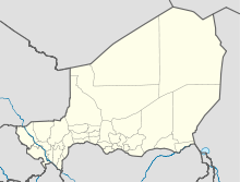

Torodi Torodi ist eine Landgemeinde im Departement Say der nigrischen Region Tillabéri. Sie hat 151.541 Einwohner (2010).[1]
Torodi liegt in den Feuchtgebieten südlich des Flusses Niger. Südlich des Ortszentrums befindet sich das Flussbett des Goroubi, eines Nebenflusses des Niger. Das Gemeindegebiet ist in 97 administrative Dörfer, vier traditionelle Dörfer, 202 Weiler und ein Lager gegliedert.[2] In geologischer Hinsicht befindet sich die auf 184 m Seehöhe gelegene Gemeinde in einem dem Erdzeitalter Präkambrium zugerechneten Gebiet.[3] In Torodi findet wöchentlich ein großer Viehmarkt statt. Durch den Ort führt eine Nationalstraße, die die nigrische Hauptstadt Niamey mit Ouagadougou verbindet, der Hauptstadt des Nachbarstaats Burkina Faso.
Literatur
- Frédéric Giraut: Fonctions, formes et perspectives d'une petite ville à la grande périphérie d'une métropole: Torodi en République du Niger. Diplomarbeit, Universität Paris I 1986
Einzelnachweise
- ↑ Institut national de la statistique (Hrsg.): Annuaire statistique des cinquante ans d’indépendence du Niger. Niamey 2010 (Online-Version), S. 56.
- ↑ Répertoire National des Communes (RENACOM). Website des Institut National de la Statistique, abgerufen am 22. Januar 2011.
- ↑ Thomas Krings: Sahelländer. WBG, Darmstadt 2006, ISBN 3-534-11860-X, S. 16.
Schlagen Sie auch in anderen Wörterbüchern nach:
Say (Departement) — Say ist ein Departement im Südwesten der Region Tillabéri im westafrikanischen Staat Niger. Es erstreckt sich über eine Fläche von 14.430 km². Der Norden des Departements gehört zur Sahelzone, der Süden zur Großlandschaft Sudan. Im Norden grenzt… … Deutsch Wikipedia
Diffa — Urban Commune … Wikipedia
Departments of Niger — the pre 2011 36 Departments of Niger. A further 27 were then carved out of existing divisions … Wikipedia
N'guigmi — Nguigmi, Ngigmi Camel riders line up outside the residence of the traditional chief of Nguigmi … Wikipedia
Dosso, Niger — Dosso Officials at the opening of the Regional Maternity hospital, 2008 … Wikipedia
Djado Plateau — The ruined city of Djado, with nomadic women gathered in the foreground. October 1989. The Djado Plateau lies in the Sahara, in north eastern Niger. It is known for its cave art (often of large mammals long since absent from the area), but is now … Wikipedia
Dakoro — is a town and commune located in the Maradi Region of Niger. Coordinates: 14°30′N 6°45′E / … Wikipedia
Dogondoutchi — Dogondoutchi … Wikipedia
Mayahi — (var. Mayaki) is a town located in the Maradi Region of Niger. It is the seat of Mayahi Department and a Commune about 45km from Tessaoua. In the mid 1990s it had a population of 2,200.[1] The name Mayaki is also a rulers title among the Sudié… … Wikipedia
Communes of Niger — Niger This article is part of the series: Politics and government of Niger Constitution President … Wikipedia
Torodi

18+
© Academic, 2000-2024
- Kontaktieren Sie uns: Unterstützung, Werbung
Wörterbücher Export, schritte mit PHP, Joomla, Drupal, WordPress, MODx.