- Waitahuna
-
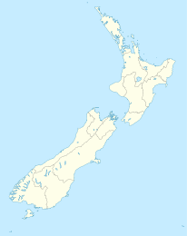
Waitahuna Koordinaten 45° 59′ S, 169° 46′ O-45.983333333333169.76666666667Koordinaten: 45° 59′ S, 169° 46′ O Region Otago Distrikt Clutha-Distrikt Waitahuna (Māori: "Tal des Wassers" [1]) ist ein kleines Dorf in der Region Otago auf der Südinsel Neuseelands, 11 km südöstlich von Lawrence. Der Ort liegt 164 m über dem Meeresspiegel.[2]
Im 19. Jahrhundert florierte der Ort nach der Entdeckung von Gold. Das Waitahuna Gully Miner's Monument gedenkt dieser Entdeckung und der Bergarbeiter, die im Ort lebten. Der Ort besitzt außerdem eine um 1905/06 erbaute Hängebrücke über den Waitahuna River.
Waitahuna hat eine Grundschule und eine Grundschule mit 32 Schülern im Jahre 2009 und einem Decile rating von 7.[3] Sie geht auf die 1875, zur Zeit des Goldrausches, errichtete Waitatiuna Public School zurück, die damals 3 Räume, einer davon eine Bibliothek, zurück. [1]
Der Ort war kurzzeitig ein Eisenbahnendpunkt, nachdem die Teilstrecke der später Roxburgh Branch benannten Nebenbahn der Main South Line von Clarksville aus am 22. Januar 1877 eröffnet wurde. Etwas mehr als 2 Monate später wurde der nächste Teilabschnitt bis Lawrence eingeweiht. Bis 4. September 1936 wurde der Ort von Passagierzügen bedient, danach bis zur Schließung der Linie am 1. Juni 1968 nur noch von Güterzügen. Der Lagerschuppen, das Bahnhofsgebäude und die Herrentoiletten sind am Ort des ehemaligen Bahnhofs erhalten geblieben.
Der Ort ist durch den State Highway 8 an das Schnellstraßennetz angebunden.
Weblinks
- Eintrag über Waitahuna in der Cyclopedia von 1905 mit Informationen zu damals bekannten Einwohnern
- Wetter in Waitahuna
Quellen
- New Zealand Travel Atlas, Wise Maps Auckland. ISBN 0-908794-47-9
- ↑ a b The Cyclopedia of New Zealand (Otago & Southland Provincial Disctricts), The Cyclopedia Company, Limited, Christchurch 1905 Digitalisat, abgerufen 16. Mai 2009
- ↑ Fallingrain.com
- ↑ Te kete Ipurangi
Kategorien:- Ort in der Region Otago
- Otago (Region)
Wikimedia Foundation.

