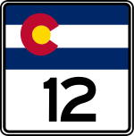
Colorado State Route 112

Colorado State Route 112
Straßenschild der Colorado State Route 112
Basisdaten
Gesamtlänge:  28 mi/45 km
Anfangspunkt:  US 160.svg US 160 bei Del Norte
Endpunkt:  Colorado 17.svg CO 17 bei Hooper
Countys:  Rio Grande County
Saguache County
Alamosa County

Die Colorado State Route 112 (kurz CO 112) ist eine State Route im US-Bundesstaat Colorado, die in Nord-Süd-Richtung verläuft.

Die State Route beginnt am U.S. Highway 160 nahe Del Norte und endet nahe Hooper an der Colorado State Route 17. Westlich von Center trifft sie auf den U.S. Highway 285.

Siehe auch


Wikimedia Foundation.

Игры ⚽ Нужно решить контрольную?

Schlagen Sie auch in anderen Wörterbüchern nach:

  • Colorado State Highway 112 — Basisdaten Gesamtlänge:  28 mi/45 km Bundesstaat:  Colorado …   Deutsch Wikipedia

  • Colorado State Route 17 — Basisdaten Gesamtlänge:  88 mi/142 km Anfangspunkt:  …   Deutsch Wikipedia

  • Colorado State Highway 112 — State Highway 112 Route information …   Wikipedia

  • Colorado State Highway 17 — Basisdaten Gesamtlänge:  88 mi/142 km Bundesstaat:  Colorado …   Deutsch Wikipedia

  • Colorado State Highway 17 — State Highway 17 Route information Maintained by CDOT Length: 88.5 mi …   Wikipedia

  • Colorado State Highway 113 — State Highway 113 Route information Maintained by CDOT Length: 18.8 mi …   Wikipedia

  • Colorado State Highway 110 — State Highway 110 Route information Maintained by CDOT Length: 0.186 mi …   Wikipedia

  • Arizona State Route 389 — Infobox road marker state=AZ highway name= name notes= type=state route=389 alternate name= maint= length mi=32.60 length round=2 length ref=cite web |url=http://tpd.az.gov/data/reports/2006SHSLog.pdf |title=2006 ADOT Highway Log |author=Arizona… …   Wikipedia

  • Utah State Route 128 — For the former highway, see Utah State Route 128 (1931–1933). State Route 128 Upper Colorado River Scenic Byway Dinosaur Diamond Prehistoric Highway …   Wikipedia

  • Interstate 110 and State Route 110 (California) — Infobox road marker state=CA type=I route=110 name=Interstate 110, State Route 110 alternate name=Harbor Freeway, Pasadena Freeway section=410 maint=Caltrans length mi=31.819 length ref= length round=2 history=Highway in 1930s, number in 1964 (SR …   Wikipedia

Share the article and excerpts

Direct link
Do a right-click on the link above
and select “Copy Link”