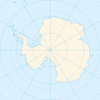
Dennistoun Glacier

Dennistoun Glacier
Dennistoun-Gletscher (Antarktis)
DMS
Dennistoun-Gletscher

Der Dennistoun-Gletscher (englisch Dennistoun Glacier) ist ein Gletscher, der 80 Kilometer lang ist und die nördliche Flanke der Admiralitätsberge in der Antarktis entwässert, vor allem die Hänge des Mount Black Prince, des Mount Royalist und des Mount Adam. Er strömt zwischen der Lyttelton Range und der Dunedin Range in Richtung Nordwesten, bevor er den letzteren Gebirgszug umrundet und sich nach Osten wendet, um südlich des Kap Scott ins Meer zu fließen. Die Zunge des Gletschers wurde 1911 bis 1912 von der Nordgruppe der Terra-Nova-Expedition unter Victor Campbell kartiert.

Der Gletscher ist nach James R. Dennistoun benannt, einem neuseeländischen Alpinisten, der an Bord der Terra Nova für die Maultiere verantwortlich war. Der gesamte Gletscher wurde vom USGS von 1960 bis 1963 nach Forschungen und US-Navy-Luftfotos kartiert. Irrtümlich wurde der Name Fowlie-Gletscher, ein Nebengletscher, auf dieses geografische Merkmal angewendet.

-71.1833333333331687Koordinaten: 71° 11′ S, 168° 0′ O


Wikimedia Foundation.

Игры ⚽ Нужно решить контрольную?

Schlagen Sie auch in anderen Wörterbüchern nach:

  • Dennistoun Glacier — …   Wikipedia

  • Dennistoun-Gletscher — 71.183333333333168 Koordinaten: 71° 11′ S, 168° 0′ O …   Deutsch Wikipedia

  • Nash Glacier — The Nash Glacier is a 32 km (20 mi) long glacier, draining the northern slopes of Dunedin Range in the Admiralty Mountains. The terminus of this glacier merges with that of Wallis Glacier and Dennistoun Glacier before reaching the sea… …   Wikipedia

  • Atkinson Glacier — (coord|71|30|S|167|25|E|type:glacier region:AQ|display=inline,title) is a glacier between Findlay Range and Lyttelton Range, Admiralty Mountains, flowing northward into Dennistoun Glacier. Named by the New Zealand Antarctic Place Names Committee… …   Wikipedia

  • Список ледников Антарктики — Название Координаты Протяжённость Комментарии Ледник Огорда 66°46′0″ ю. ш. 64°31 0  з. д.  …   Википедия

  • Lyttelton Range — The Lyttelton Range (coord|71|33|S|167|45|E|) is a narrow northwest trending mountain range located south of Dunedin Range in the Admiralty Mountains of Antarctica. The range is 26 km (16 mi) long and forms the western wall of the upper part of… …   Wikipedia

  • Cape Scott — (coord|71|07|S|168|05|E|) is a cape at the western side of the terminus of Dennistoun Glacier on the northern coast of Victoria Land in Antarctica. Discovered by Captain James Ross, 1841, who named it for Peter A. Scott, Mate on the Terror …   Wikipedia

  • Admiralty Mountains — Range Mount Herschel (3,335 m) in the Admiralty Mountains as seen from Cape Hallett …   Wikipedia

  • Anare Mountains — The Anare Mountains (coord|70|55|S|166|00|E|type:mountain) is a large group of mainly snow covered peaks and ridges along the northern coast of Victoria Land, Antarctica. The group is bounded on the north and east by the Pacific Ocean, on the… …   Wikipedia

Share the article and excerpts

Direct link
Do a right-click on the link above
and select “Copy Link”