Dunedin Range

Dunedin Range
-71.4167.9
Dunedin Range (Antarktis)
Dunedin Range
Dunedin Range
Antarktis

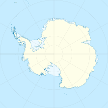
Die Dunedin Range (deutsch Dunedin-Gebirge) ist eine in Nordwestrichtung verlaufende Gebirgskette, die 37 Kilometer lang und 3 bis 6 Kilometer breit ist. Sie befindet sich 8 Kilometer östlich der Lyttelton Range in den Admiralitätsbergen in Victorialand, Antarktis. Kartiert wurde sie von 1960 bis 1963 von der USGS nach Forschungen und US-Navy-Luftfotos.

Benannt wurde die Range vom US-ACAN nach der Stadt Dunedin in Neuseeland, die mit der Zeit eine enge Verknüpfung mit Antarktisexpeditionen erfuhr; auch wurde die Freundlichkeit und Kooperation der Bevölkerung mit amerikanischen Expeditionsteams gewürdigt.


Wikimedia Foundation.

Игры ⚽ Нужен реферат?

Schlagen Sie auch in anderen Wörterbüchern nach:

  • Dunedin Range — The Dunedin Range (71°24′S 167°54′E / 71.4°S 167.9°E / 71.4; 167.9) is a northwest trending mountain range, 37 km (23 mi) long and 3 to 6 km (2 to 4 mi) wide, located 8 km east of …   Wikipedia

  • Dunedin Public Libraries — Kā Kete Wānaka O Ōtepoti(Māori) Established 1908 Location Dunedin, New Zealand Coordinates …   Wikipedia

  • Dunedin Railway Station — Anzac Square and Dunedin Railway Station Station statistics Address Anzac Square, Dun …   Wikipedia

  • Dunedin-Waitati Highway — Dunedin Waitati Hwy looking north from near the Pigeon Flat Overbridge. Blueskin Bay is visible in the background …   Wikipedia

  • Dunedin Technical — Voller Name Dunedin Technical Association Football Club Ort Dunedin, Neuseeland Gegründet 1920 Stadion …   Deutsch Wikipedia

  • Dunedin — For other uses, see Dunedin (disambiguation). Dunedin Māori: Ōtepoti   Metropolitan Area   …   Wikipedia

  • Dunedin Southern Motorway — State Highway 1 Dunedin Northern and Southern Motorways (marked in red other parts of …   Wikipedia

  • Dunedin Astronomical Society — The Dunedin Astronomical Society Incorporated (DAS) is an amateur astronomical group operating from the Beverly Begg Observatory Dunedin, New Zealand. It is affiliated[1] with the Royal Astronomical Society of New Zealand and with the Otago… …   Wikipedia

  • Lyttelton Range — 71.55167.75 Koordinaten: 71° 33′ S, 167° 45′ O …   Deutsch Wikipedia

  • Lyttelton Range — The Lyttelton Range (coord|71|33|S|167|45|E|) is a narrow northwest trending mountain range located south of Dunedin Range in the Admiralty Mountains of Antarctica. The range is 26 km (16 mi) long and forms the western wall of the upper part of… …   Wikipedia

Share the article and excerpts

Direct link
Do a right-click on the link above
and select “Copy Link”