- Eye of Kuruman
-
Eye of Kuruman Das „Eye of Kuruman“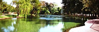
Geographische Lage Südafrika Daten Koordinaten 27° 27′ 49″ S, 23° 26′ 11″ O-27.463523.4363Koordinaten: 27° 27′ 49″ S, 23° 26′ 11″ O 

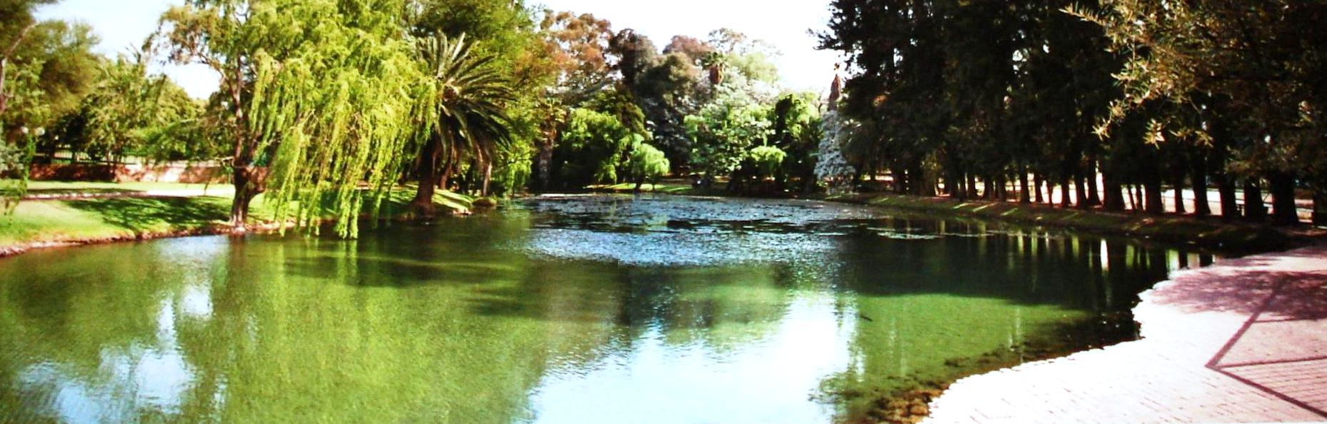
Das Eye of Kuruman (engl. für ‚Auge von Kuruman‘, afrikaans Die Oog) ist ein Quelltopf in der Stadt Kuruman (Gemeinde Ga-Segonyana im Distrikt John Taolo Gaetsewe) in der Provinz Nordkap in Südafrika. Sie ist die stärkste bekannte natürliche Quelle der Südhalbkugel.
Die Quelle bildet einen kleinen See in der Mitte der Stadt direkt an der Nationalstraße N14 und befindet sich in einem eingezäunten Park. Sie liefert eine stete Schüttung von täglich rund 20.000 m³ kristallklarem Wasser mit Trinkwasserqualität. Das Wasser versorgt die Stadt Kuruman und wird direkt im Quelltopf entnommen.
Inhaltsverzeichnis
Geschichte
Die Quelle war seit unbekannter Zeit den in der Gegend ansässigen Menschen bekannt und wurde im Rahmen der Erschließung des inneren Afrikas von Durchreisenden genutzt. Die „offizielle“ Entdeckung der Quelle erfolgte 1801 während der Truter Sommervill expedition durch Samuel Daniel. Die Quelle ermöglichte 1826 Robert Moffat die Anlage einer Missionsstation – aus der sich die Stadt Kuruman (die Oase der Kalahari) in der Halbwüste der Kalahari entwickelte. Am 17. September 1992 wurde das „Eye of Kuruman“ zu einem „National Monument“ erklärt.
Zweite Quelle
Etwas östlich des Ortseingangs von Kuruman befindet sich (südlich der N14) eine zweite - kleinere - Quelle.
Fische
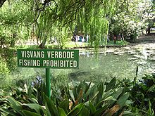 Schild „Fischen verboten“ am Eye of Kuruman
Im Eye of Kuruman leben verschiedene Fischarten – im Wesentlichen Goldfische, Karpfen, Barben und Afrikanische Buntbarsche –, von denen der Messingmaulbrüter (Pseudocrenilabrus philander) eine im Eye of Kuruman endemische Unterart bildet.
Quellen
- B. J .B. Erasmus: On Route in South Africa – A Region by Region Guide to South Africa. 1996. ISBN 1868420256
- Beschreibung: http://www.suedafrika.net/kalahari/g6kala04.htm
- Details zu Pseudocrenilabrus philander: http://www.cichlidae.com/article.php?id=47
Kategorien:- Quelle
- See in Afrika
- See in Südafrika
- Nordkap (Provinz)


Wikimedia Foundation.