Akurdet

Akurdet
Agordat (Eritrea)
DMS
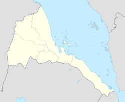
Lage von Agordat in Eritrea

Agordat (auch Ākʿordat, Akurdet, Adirdat, Akwirdet, Akirdat oder Figordat) ist eine Stadt in der Region Gash-Barka im westlichen Tiefland Eritreas und mit etwa 30.000 Einwohnern drittgrößte des Landes (Stand 2005). Bis 1995 war sie die Hauptstadt der Provinz, bevor diese nach Barentu verlegt wurde. Die Stadt liegt auf 615 m ü NN und am Fluss Barka, dessen sandiges Bett aber in der Trockenzeit regelmäßig austrocknet. Das Klima in der Stadt zeichnet sich durch hohe bis sehr hohe Temperaturen aus (durchschnittliche Tageshöchsttemperaturen je nach Monat zwischen 33-40 °C) bei häufigen Sandstürmen, den Haboob, aus.

Agordat ist bekannt für seine Bananenplantagen und die zweitgrößte Moschee Eritreas von 1963. Das Stadtbild ist noch aus der osmanisch/ägyptischen Zeit geprägt.

Agordat ist der westliche Endpunkt der Eisenbahnlinie nach Massawa am Roten Meer, die sowohl im Italienisch-Äthiopischen Krieg als auch im Zweiten Weltkrieg wichtige Nachschublinie war. Seit dem letzten Krieg zwischen Äthiopien und Eritrea 2000, bei dem Agordat von äthiopischen Truppen besetzt wurde, ist sie nur noch bedingt betriebsbereit.

Weblinks

  • Agordat auf Eritrea.be (zuletzt abgerufen: 17. September 2008)

15.55111111111137.8863888888897Koordinaten: 15° 33′ N, 37° 53′ O


Wikimedia Foundation.

Игры ⚽ Поможем сделать НИР

Schlagen Sie auch in anderen Wörterbüchern nach:

  • Akurdet District — Infobox Settlement name = Akurdet settlement type =District official name = other name = native name = nickname = motto = imagesize = image caption = flag size = image seal size = image shield = shield size = image blank emblem = blank emblem… …   Wikipedia

  • Agordat — Infobox Settlement official name = Pagename other name = Ak ordat native name = ኣቆርዳት nickname = settlement type = motto = imagesize = 300px image caption = flag size = image seal size = image shield = shield size = mapsize = map caption = Map of …   Wikipedia

  • Districts of Eritrea — Districts of Eritrea. The regions of Eritrea are divided into districts, as follows: Eritrea …   Wikipedia

  • Keren District — Keren   District   Country  Eritrea Region Anseba …   Wikipedia

  • North Eastern District, Eritrea — North Eastern   District   Country  Eritrea Region …   Wikipedia

  • Dghe District — Dghe   District   Country  Eritrea Region G …   Wikipedia

  • Mensura District — Mensura   District   Country  Eritrea Region Gash Barka …   Wikipedia

  • Mogolo District — Mogolo   District   Country  Eritrea Region Gash Barka …   Wikipedia

  • Molki District — Molki   District   Country  Eritrea Region Gash Barka …   Wikipedia

  • Omhajer District — Omhajer   District   Country  Eritrea Region …   Wikipedia

Share the article and excerpts

Direct link
Do a right-click on the link above
and select “Copy Link”