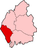
Copeland (borough) — For the constituency of the same name, see Copeland (UK Parliament constituency). Coordinates: 54°25′52″N 3°23′20″W / 54.431°N 3.389°W / … Wikipedia
Redditch — Infobox Settlement name = Redditch official name = other name = native name = nickname = settlement type = Town and Borough total type = Admin (Borough) motto = translit lang1= translit lang1 type= translit lang1 info= translit lang1 type1=… … Wikipedia
ONS coding system — In the United Kingdom, the Office for National Statistics maintains a series of codes to represent a wide range of geographical areas of the UK, for use in tabulating census and other statistical data. These codes are referred to as ONS codes or… … Wikipedia
Copeland local elections — Copeland Borough Council in Cumbria, England is elected every four years. Since the last boundary changes in 1999, 51 councillors have been elected from 25 wards.[1] Contents 1 Political control 2 Council elections … Wikipedia
Copeland (Cumbria) — Borough of Copeland Lage in Cumbria Status Borough Region North West England Verw.grafschaft Cumbria … Deutsch Wikipedia
Copeland Council election, 2007 — Map of the results of the 2007 Copeland council election. Labour in red, Conservatives in blue and independent in white. The 2007 Copeland Council election took place on 3 May 2007 to elect members of Copeland Borough Council in Cumbria, England … Wikipedia
Copeland Council election, 2011 — Map of the results of the 2011 Copeland council election. Labour in red, Conservatives in blue and independent in white. The 2011 Copeland Council election took place on 5 May 2011 to elect members of Copeland Borough Council in Cumbria, England … Wikipedia

