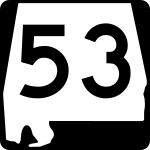
Alabama State Highway 53

Alabama State Highway 53
Straßenschild der Alabama State Route 53
Basisdaten
Gesamtlänge:  345 mi/556 km
Bundesstaat:  Alabama
Anfangspunkt:  FL 71 bei Cottonwood
Endpunkt:  Straßenschild der I-65 I-65 US 31 nahe Ardmore
Countys:  Houston County
Dale County
Pike County
Montgomery County
Elmore County
Coosa County
Talladega County
Shelby County
St. Clair County
Blount County
Marshall County
Madison County
Limestone County

Die Alabama State Route 53 (kurz AL 53) ist eine State Route im US-Bundesstaat Alabama, die in Nord-Süd-Richtung verläuft.

Die State Route beginnt an der Florida State Route 71 zwischen Cottonwood und Malone an der Staatsgrenze zu Florida. Nach 556 Kilometern endet sie westlich von Ardmore an der Interstate 65 und dem U.S. Highway 31. Die Straße teilt sich zwischen den Städten Dothan und Huntsville die Trasse mit dem U.S. Highway 231. Auf diesem Abschnitt wird sie neben dem US 231 aber nicht ausgezeichnet.

In Ardmore verläuft die State Route auf der Grenze zwischen den Bundesstaaten Alabama und Tennessee. Diese Straße wird darum auch als State Line Road bezeichnet. Zwischen Ardmore und der I-65 führt die AL 53 weiterhin für vier Kilometer parallel zur Staatsgrenze.

Siehe auch

Weblinks


Wikimedia Foundation.

Игры ⚽ Поможем написать реферат

Schlagen Sie auch in anderen Wörterbüchern nach:

  • Alabama State Route 5 — Infobox road state=AL type=SR route=5 length mi=197.775 length ref=Alabama Department of Transportation, [http://www.dot.state.al.us/NR/rdonlyres/7B15B300 359D 413A A7FA ED33C8C261CD/0/CountyMilePostMaps.pdf County Milepost Maps] , accessed… …   Wikipedia

  • Alabama State Route 143 — Infobox road state=AL type=SR route=143 length mi=28.598 length ref=Alabama Department of Transportation, [http://www.dot.state.al.us/NR/rdonlyres/7B15B300 359D 413A A7FA ED33C8C261CD/0/CountyMilePostMaps.pdf County Milepost Maps] , accessed… …   Wikipedia

  • Alabama State Route 210 — State Route 210 Route information Maintained by ALDOT …   Wikipedia

  • Alabama State Route 165 — State Route 165 is a state highway that runs through Holy Trinity, Alabama in eastern Alabama. Its northern terminus is at U.S. Route 431 south of Phenix City, Alabama, and its southern terminus is at US 431 five miles north of Eufaula, Alabama.… …   Wikipedia

  • Alabama State Route 14 — Infobox road state=AL type=AL route=14 length mi=247 length ref= [ [http://colepages.com/routes125.html Highway Route Info Routes 1 25 ] ] length round= established= direction a=West direction b=East starting terminus= junction= ending terminus=… …   Wikipedia

  • Alabama State Route 17 — Basisdaten Gesamtlänge:  340 mi/547 km Eröffnung:  1 …   Deutsch Wikipedia

  • Alabama State Route 147 — Infobox road state=AL type=AL route=147 length mi= length round= length ref= established= direction a=South starting terminus= junction= direction b=North ending terminus= counties=Lee County, Chambers County previous type=AL previous route=146… …   Wikipedia

  • Alabama State Route 25 — Infobox road state=AL type=SR route=25 alternate name=U.S. Highway 411 (north of Leeds) length mi=257.352 length ref=Alabama Department of Transportation, [http://www.dot.state.al.us/NR/rdonlyres/7B15B300 359D 413A A7FA… …   Wikipedia

  • Alabama State Route 9 — Infobox road state=AL type=SR route=9 alternate name=U.S. Highway 331 (south of Montgomery) length mi=273.069 length ref=Alabama Department of Transportation, [http://www.dot.state.al.us/NR/rdonlyres/7B15B300 359D 413A A7FA… …   Wikipedia

  • Alabama State Route 35 — Infobox road state=AL type=AL route=35 length mi=50 length ref= [ [http://colepages.com/routes2650.html Highway Route Info Routes 26 50 ] ] length round= established=1940 direction a=South direction b=North starting terminus= junction= northwest… …   Wikipedia

Share the article and excerpts

Direct link
Do a right-click on the link above
and select “Copy Link”