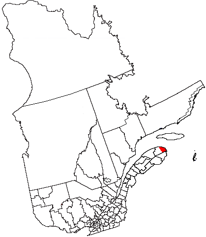
Gaspé (Québec) — Gaspé (ville) Pour les articles homonymes, voir Gaspé. Gaspé Rive nord de Gaspé centre ville Admini … Wikipédia en Français
Gaspé, Quebec — Infobox Settlement official name = Ville de Gaspé other name = native name = nickname = settlement type = Town motto = imagesize = image caption = flag size = image seal size = image shield = shield size = city logo = citylogo size = mapsize =… … Wikipedia
Gaspé — Blick auf Gaspé Lage in Québec … Deutsch Wikipedia
Gaspé — is* Gaspé, Quebec, a city * Gaspé (provincial electoral district), a provincial electoral district in Quebec * Gaspé Peninsula, a peninsula where both the city and district are located … Wikipedia
Sainte-Thérèse-de-Gaspé, Quebec — Infobox Settlement official name = Municipalité de Sainte Thérèse de Gaspé other name = native name = nickname = settlement type = Municipality motto = imagesize = image caption = flag size = image seal size = image shield = shield size = city… … Wikipedia
Gaspé railway station — is located on Rue de la Marina in the city of Gaspé, Quebec, Canada. It is the final stopover of VIA Rail s Chaleur line. The station is staffed and is wheelchair accessible.External links*VIA Station|GASP … Wikipedia
Quebec — This article is about the Canadian province. For the province s capital city, see Quebec City. For other uses, see Quebec (disambiguation). Coordinates … Wikipedia
Gaspé Airport — Infobox Airport name = Gaspé Airport IATA = YGP ICAO = CYGP type = Public owner = operator = Municipality of Gaspé city served = location = Gaspé, Quebec elevation f = 112 elevation m = 34 coordinates =… … Wikipedia
Quebec Route 197 — Infobox road province=QC type=QC route=197 maint= established= decommissioned= marker length km = 19 direction=South/North direction a=South direction b=North terminus a= jct|state=QC|QC|132 in Gaspé (Saint Majorique) terminus b=… … Wikipedia
Gaspé, península de — Península, en el sudeste de la provincia de Quebec en Canadá. Se extiende 240 km (150 mi) de este a nordeste desde el río Matapédia hasta alcanzar el golfo de San Lorenzo, que queda al sur del río San Lorenzo y al norte de la bahía de Chaleur y… … Enciclopedia Universal