- Grand Gulf State Park
-
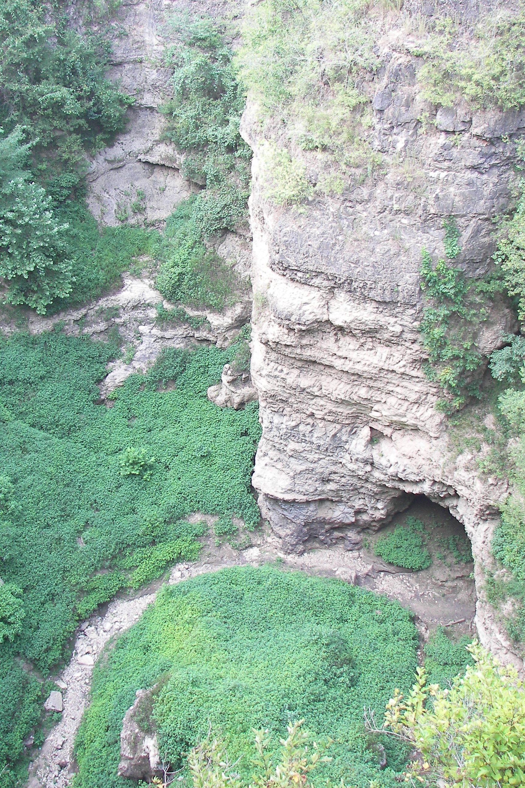
 Grand Gulf State Park im August 2007
Der Grand Gulf State Park besteht aus einer Schlucht mit teilweise eingestürztem Höhlensystem, einer Felsbrücke und einem Fluss mit Schlucklöchern. Der 134 ha große State Park liegt in 2100 m Höhe etwa 10 km westlich von Thayer im Oregon County des US-Bundesstaates Missouri.
Das Kalk- und Dolomitgestein des alten Flusshöhlensystems ist vor über 10.000 Jahren über eine Länge von über einem Kilometer eingestürzt und bildet eine 40 m tiefe schmale Schlucht. Das Einzugsgebiet des Grand Gulf ist 51 km² groß und bei starken Regenfällen kann der Wasserpegel in der Schlucht bis zu 30 m steigen um dann erst nach einigen Wochen wieder den Normalpegel zu erreichen.[1] In der Schlucht fließt das Gewässer teilweise unterirdisch und bildet dabei eine natürliche Felsbrücke, die 61 m überspannt.[2] Färbeversuche haben ergeben, dass ein Großteil des Wassers das in der Schlucht und den Karsthöhlen in Schlucklöchern verschwindet nach 15 km südöstlich im Mammoth Spring Quelltopf des Mammoth Spring State Park wieder zu Tage tritt und dort nachgewiesen werden kann.[3]
1971 wurde das Gebiet als National Natural Landmark ausgezeichnet[4] und 1984 wurde der State Park eingerichtet. Wanderwege führen über die Felsbrücke und durch Wälder an den Rändern der Schlucht entlang. Eine hölzerne Aussichtsplattform bietet einen Überblick über die Schlucht und über eine hölzerne Treppe an den steilen Wänden wurde ein Zugang zum Grund der Schlucht geschaffen. Übernachtungsmöglichkeiten sind im Parkgelände nicht vorhanden.
Weblinks
- Offizielle Webseite (englisch)
- Fotos und Schautafeln bei flickr
- Grand Gulf State Park im Geographic Names Information System des United States Geological Survey
Einzelnachweise
- ↑ http://www.mostateparks.com/grandgulf/geninfo.htm
- ↑ http://www.mostateparks.com/grandgulf.htm
- ↑ http://gorp.away.com/gorp/location/ar/parks/mammoth.htm
- ↑ http://www.nature.nps.gov/nnl/Registry/USA_Map/States/Missouri/NNL/GG/index.cfm
36.543915-91.6437442100Koordinaten: 36° 32′ 38,1″ N, 91° 38′ 37,5″ WKategorien:- Geographie (Missouri)
- National Natural Landmark
- State Park in Missouri
Wikimedia Foundation.