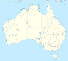
Gurig National Park

Gurig National Park
Garig Gunak Barlu National Park
Garig-Gunak-Barlu-Nationalpark (Australien)
DEC
Lage: Northern Territory
Besonderheit: Meer, Küstenlandschaft mit Mangroven, Regenwald, Korallenriffe
Nächste Stadt: Jabiru
Fläche: 2207 km²
Gründung: 2000

Der Garig-Gunak-Barlu-Nationalpark (früher Gurig-Nationalpark) ist ein im Jahr 2000 gegründeter Nationalpark auf der Cobourg-Halbinsel in der australischen Verwaltungseinheit Northern Territory, 570 km nordöstlich von Darwin. Die Landfläche des Parks beträgt 2207 km², die Gesamtfläche mit Teilen der Arafurasee 4500 km². Der Park entstand aus dem Zusammenschluss des Gurig-Nationalparks mit dem Cobourg-Marine-Park. Die nächstgelegene Stadt ist Jabiru.

Der Park umfasst die gesamte Halbinsel und besteht aus Überschwemmungsgebieten, Sümpfen, Eukalyptuswäldern, Palmen, Mangroven und einem Korallenriff im vorgelagerten Cobourg-Marine-Park. Er befindet sich im Besitz der Aborigines und wird von der Parks and Wildlife Commission of the Northern Territory mitverwaltet.

Weblinks

-11.365606944444132.2396857Koordinaten: 11° 21′ 56,2″ S, 132° 14′ 22,9″ O


Wikimedia Foundation.

Игры ⚽ Поможем написать курсовую

Schlagen Sie auch in anderen Wörterbüchern nach:

  • Garig Gunak Barlu National Park — Infobox protected area of Australia | name = Garig Gunak Barlu National Park iucn category = II caption = locator x = 132 locator y = 7 nearest town or city = Jabiru coordinates = coord|11|06|13|S|132|17|20|E|type:landmark region:AU area = 4,500… …   Wikipedia

  • Garig Gunak Barlu National Park — Garig Gunak Barlu National Park …   Deutsch Wikipedia

  • Gurig-Nationalpark — Garig Gunak Barlu National Park …   Deutsch Wikipedia

  • Principal national parks of the world — ▪ Table Principal national parks of the world Africa Europe and Russia Asia North America and the Caribbean Australia and Oceania South America Africa country national park date area description protected status national park status square miles… …   Universalium

  • Northern Territory — For similar terms, see Northern Territories (disambiguation). Coordinates: 20°0′S 133°0′E / 20°S 133°E / 20; 133 …   Wikipedia

  • Protected areas of the Northern Territory — The Northern Territory contains 95 separate Protected Areas with a total area of 53,505 km² (land area: 51,269 km² – 3.81% of the territory’s area). Ten of these are National parks, totalling 19,622 km² (1.46% of the territory’s… …   Wikipedia

  • Port Essington — This article is about the early Australian settlement. For the settlement in British Columbia, Canada, see Port Essington, British Columbia.Port Essington is an inlet and historic site located on the Cobourg Peninsula in the Garig Gunak Barlu… …   Wikipedia

  • Garig-Gunak-Barlu-Nationalpark — Garig Gunak Barlu National Park …   Deutsch Wikipedia

  • Parque Nacional Garig Gunak Barlu — Saltar a navegación, búsqueda Parque Nacional Garig Gunak Barlu …   Wikipedia Español

  • Nationalparks in Australien — In Australien gibt es mehrere Hundert Nationalparks. Der größte Teil von ihnen untersteht den Regierungen der jeweiligen Bundesstaaten; lediglich eine kleine Anzahl Parks wird vom Ministerium Department of Sustainability, Environment, Water,… …   Deutsch Wikipedia

Share the article and excerpts

Direct link
Do a right-click on the link above
and select “Copy Link”