Howardian Hills

Howardian Hills
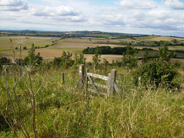
Blick von den Howardian Hills

Die Howardian Hills sind ein Gebiet von außergewöhnlicher Naturschönheit in der Grafschaft North Yorkshire in der Region Yorkshire and the Humber in England, Großbritannien.

Die Hügel haben ihren Namen von der Adelsfamilie der Howards, die wahrscheinlich große Gebiete in den Hügeln besaßen und deren herrlicher Landsitz, Schloss Howard, sich am Rande der Hügel befindet.

Von Brandsby bis Coneysthorpe liegen zahlreiche Dörfer entlang einer Linie natürlicher Quellbrunnen.

Weblinks


Wikimedia Foundation.

Игры ⚽ Поможем сделать НИР

Schlagen Sie auch in anderen Wörterbüchern nach:

  • Howardian Hills — Geobox Protected Area name = Howardian Hills native name = other name = other name1 = category local = Area of Outstanding Natural Beauty category iucn = image size = 200px image caption = View of the Howardian Hills country = United Kingdom… …   Wikipedia

  • Mendip Hills — Coordinates: 51°18′N 2°44′W / 51.3°N 2.733°W / 51.3; 2.733 …   Wikipedia

  • Malvern Hills — For the local government district in Worcestershire, see Malvern Hills (district). Malvern Hills Area of Outstanding Natural Beauty Malvern Hills in J …   Wikipedia

  • Chiltern Hills — near Nettlebed Country England Counties Bedfordshire …   Wikipedia

  • Area of Outstanding Natural Beauty — A map of all AONBs An Area of Outstanding Natural Beauty (AONB) is an area of countryside considered to have significant landscape value in England, Wales or Northern Ireland, that has been specially designated by the Countryside Agency (now… …   Wikipedia

  • AONB — Als Area of Outstanding Natural Beauty (AONB; dt.: Gebiet von außerordentlicher natürlicher Schönheit) werden unter besonderem Schutz stehende ländliche Gebiete in England, Wales und Nordirland bezeichnet. Der Hauptzweck einer Klassifizierung als …   Deutsch Wikipedia

  • River Derwent, Yorkshire — Geobox River name = Derwent native name = other name = Darwent archaically other name1 = map size = map caption = Map of the Catchment Area of the River Derwent country = England country1 = region = Yorkshire region1 = city = city1 = length = 115 …   Wikipedia

  • River Rye, Yorkshire — The River Rye is a river in the English county of North Yorkshire. It rises just south of the Cleveland Hills, east of Osmotherley, and flows through Hawnby, Rievaulx, Helmsley, Nunnington, West and East Ness, Butterwick, Brawby, and Ryton,… …   Wikipedia

  • Topographical areas of Yorkshire — Main article: Yorkshire See also: Geology of Yorkshire A simplified geology of Yorkshire. In Yorkshire there is a very close relationship between the major topographical areas and the geological period in which they were formed. The Pennine chain …   Wikipedia

  • Vale of Pickering — The Vale of Pickering is a low lying flat area of land in North Yorkshire, England. It is drained by the River Derwent. The landscape is rural with scattered villages and small market towns. It has been inhabited continuously from the Mesolithic… …   Wikipedia

Share the article and excerpts

Direct link
Do a right-click on the link above
and select “Copy Link”