- Anahawan
-
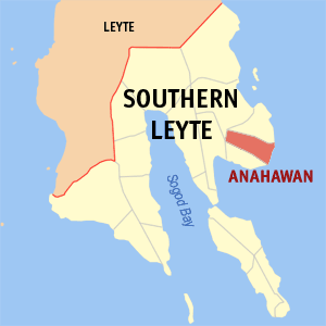
Municipality of Anahawan Lage von Anahawan in der Provinz Southern Leyte 
Basisdaten Bezirk: Eastern Visayas Provinz: Southern Leyte Barangays: 14 Distrikt: 1. Distrikt von Southern Leyte PSGC: 086401000 Einkommensklasse: 5. Einkommensklasse Haushalte: 1514 Zensus 1. Mai 2000Einwohnerzahl: 8.032 Zensus 1. August 2007Koordinaten: 10° 17′ N, 125° 16′ O10.277125.263Koordinaten: 10° 17′ N, 125° 16′ O Postleitzahl: 6610 Bürgermeister: Roberto Armonia Loquinte Offizielle Webpräsenz: www.anahawan-sleyte.gov.ph Geographische Lage auf den Philippinen 

Anahawan Anahawan ist eine philippinische Stadtgemeinde in der Provinz Southern Leyte. Nach dem Zensus vom 1. Mai 2000 hat sie 7209 Einwohner in 1514 Haushalten.
Baranggays
Anahawan ist politisch in 14 Baranggays unterteilt.
- Amagusan
- Calintaan
- Canlabian
- Capacuhan
- Kagingkingan
- Lewing
- Lo-ok
- Mahalo
- Mainit
- Manigawong
- Poblacion
- San Vicente
- Tagup-on
- Cogon
Städte und Stadtgemeinden in der Provinz Southern LeyteStädte: Maasin City
Stadtgemeinden: Anahawan | Bontoc | Hinunangan | Hinundayan | Libagon | Liloan | Limasawa | Macrohon | Malitbog | Padre Burgos | Pintuyan | Saint Bernard | San Francisco | San Juan | San Ricardo | Silago | Sogod | Tomas Oppus
Wikimedia Foundation.
Schlagen Sie auch in anderen Wörterbüchern nach:
Anahawan — may refer to: * Anahawan, Southern Leyte * Anahawan, barangay in Bato, Leyte … Wikipedia
Anahawan — 1 Original name in latin Anahawan Name in other language Anahawan State code PH Continent/City Asia/Manila longitude 10.3429 latitude 124.8782 altitude 50 Population 2640 Date 2012 01 17 2 Original name in latin Anahawan Name in other language… … Cities with a population over 1000 database
Anahawan, Southern Leyte — Anahawan is a 5th class municipality in the province of Southern Leyte, Philippines. According to the 2000 census, it has a population of 7,209 people in 1,514 households.BarangaysAnahawan is politically subdivided into 14 barangays.* Amagusan *… … Wikipedia
PH-SLE — Lage der Provinz Southern Leyte Southern Leyte ist eine Provinz der Philippinen. Sie gehört politischen dem Regierungsbezirk Eastern Visayas (Region VIII) an. Southern Leyte war einmal eine Unterprovinz der ehemaligen großen Provinz Leyte, ehe… … Deutsch Wikipedia
Southern Leyte — Infobox Philippine province name = Southern Leyte sealfile = Ph seal southern leyte.png region = Eastern Visayas (Region VIII) capital = Maasin City founded = May 22, 1959 pop2000 = 390,847 pop2000rank = 18th smallest popden2000 = 208… … Wikipedia
Southern Leyte — Lage der Provinz Southern Leyte Southern Leyte ist eine Provinz der Philippinen. Sie gehört politisch dem Regierungsbezirk Eastern Visayas (Region VIII) an. Southern Leyte war einmal eine Unterprovinz der ehemaligen großen Provinz Leyte, ehe… … Deutsch Wikipedia
Legislative districts of Leyte — Philippines This article is part of the series: Politics and government of the Philippines … Wikipedia
Tomas Oppus — Municipality of Tomas Oppus Lage von Tomas Oppus in der Provinz Southern Leyte Basisdaten Bezirk … Deutsch Wikipedia
Siargao Islands Protected Landscape and Seascape — 9.8666666666667126.05 Koordinaten: 9° 52′ N, 126° 3′ O … Deutsch Wikipedia
Sibagat, Agusan del Sur — Sibagat is a 3rd class municipality in the province of Agusan del Sur, Philippines. According to the 2000 census, it has a population of 28,685 people in 5,289 households. The town is 29 kilometers away from Butuan City. Its economy is dependent… … Wikipedia
Anahawan

18+
© Academic, 2000-2026
- Kontaktieren Sie uns: Unterstützung, Werbung
Wörterbücher Export, schritte mit PHP, Joomla, Drupal, WordPress, MODx.