- KICT
-
Wichita Mid-Continent Airport Kenndaten IATA-Code ICT ICAO-Code KICT Koordinaten 37° 39′ 0″ N, 97° 25′ 59″ W37.649944444444-97.433055555556406Koordinaten: 37° 39′ 0″ N, 97° 25′ 59″ W 406 m ü. MSLVerkehrsanbindung Entfernung vom Stadtzentrum 8 km südwestlich von Wichita Straße I-235/US 54/US 400 Basisdaten Eröffnung 1954 Betreiber Wichita Airport Authority Fläche Passagiere 1.596.229 [1] (2007) Luftfracht 32.315 t [1] (2007) Flug-
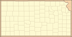
bewegungen157.654 [1] (2007) Start- und Landebahnen 01R/19L 2.225 m × 46 m Beton 01L/19R 3.140 m × 46 m Beton 14/32 1.921 m × 46 m Beton Der Wichita Mid-Continent Airport (IATA: ICT, ICAO: KICT) ist ein kommerzieller Flughafen. Er liegt im Südwesten von Wichita im Sedgwick County im Bundesstaat Kansas in den Vereinigten Staaten und ist der größte Flughafen in Kansas.
Inhaltsverzeichnis
Geschichte
Der Wichita Mid Continent Airport wurde im Jahr 1951 von der United States Air Force als Militärbasis konzipiert. Die Air Force beabsichtigte, den "Wichita Municipal Airport" zu erwerben und dort die McConnell Air Force Base einzurichten. Das Verfahren ging vor Gericht. Wichita's Park Board erwarb jedoch zügig 1923 acres (7,8 km ²) Land im Südwesten von Wichita und der Bau des neuen "Wichita Municipal Airport" war nach etwa 3,5 Jahren abgeschlossen. Der neue Flughafen wurde am 31. Oktober 1954 eingeweiht. Im Jahr 1973 erhielt er den neuen Namen Wichita Mid - Kontinent Flughafen, nachdem Kansas City seinen Mid-Continent Airport zum Flughafen Kansas City International Airport umbenannt hatte.
Rufzeichen
Die IATA-Kennung ICT des Flughafens ist eigentlich die Abkürzung für Wichita. Zu jenem Zeitpunkt hatte die Federal Communications Commission verboten, Flughäfen mit einem auf "K" (also z.B. Kansas International, KIN) oder "W" (z.B Wichita International, WIN) beginnenden Rufzeichen zu betreiben. Die Benennungskonvention sah dafür vor, das stattdessen der zweite Buchstabe des Ortsnamens zusammen mit einer phonetisch verständlichen Erweiterung verwendet werden sollte, um die Verständlichkeit im Sprechfunk zu optimieren. Aus ähnlichen Gründen konnte Kansas City sich auch nicht als KCI bezeichnen, als im Jahr 1972 der Mid-Contintent International Airport zum Kansas City International Airport umbenannt wurde, oberhalb hat Kansas City immer noch die Kennung MCI. Die IATA ändert nur sehr ungern diese Bezeichnungen, weil sie dann auch auf Navigationsinstrumenten und Karten geändert werden müssen.
Fluggesellschaften und Flugziele
- AirTran Airways Gate 12 (Atlanta)
- Allegiant Air Gate 6 (Las Vegas, Orlando, Sanford)
- American Airlines Gate 5 (Dallas / Fort Worth)
- AmericanConnection von Chautauqua Airlines (St. Louis)
- AmericanConnection von Trans States Airlines (St. Louis)
- American Eagle (Chicago O'Hare, Dallas / Fort Worth)
- Continental Airlines Gate 3
- Continental Express von ExpressJet Airlines (Houston - Intercontinental)
- Delta Air Lines Gate 11
- Delta Connection von Atlantic Southeast Airlines (Atlanta)
- Delta Connection von ExpressJet Airlines (Los Angeles)
- Frontier Airlines Gate 7
- Frontier Airlines von ExpressJet Airlines (Denver)
- Frontier Airlines Republik Airlines (Denver) (Wiederaufnahme 15. Dezember)
- FrontierExpress von Lynx Aviation (Denver)
- Northwest Airlines Gate 2
- Northwest Airlink betrieben von Pinnacle Airlines (Memphis, Minneapolis / St. Paul)
- United Airlines Gate 10 (Chicago O'Hare, Denver)
- United Express von SkyWest (Chicago O'Hare, Denver, Los Angeles)
- US Airways Gate 1
- US Airways Express von Mesa Airlines (Phoenix)
Einzelnachweise
Weblinks
- Homepage des Flughafens Wichita (englisch)
Wikimedia Foundation.

