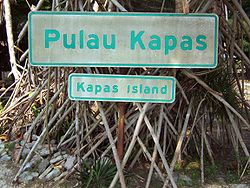
Kapas Island

Kapas Island

Vorlage:Infobox Insel/Wartung/Fläche fehltVorlage:Infobox Insel/Wartung/Höhe fehlt

Kapas Island
Island sign @ Pulau Kapas, Malaysia (234433048).jpg
Gewässer Südchinesisches Meer
Geographische Lage 5° 12′ 56″ N, 103° 16′ 17″ O5.2155555555556103.27138888889Koordinaten: 5° 12′ 56″ N, 103° 16′ 17″ O
Kapas Island (Malaysia)
Kapas Island

Kapas (malaiisch: Pulau Kapas) ist eine mit Dschungel bewachsene Insel, 10 Kilometer in südöstlicher Richtung vor der Küste von Kuala Terengganu, Malaysia. Im Norden liegt in wenigen 100 m Entfernung die weit kleinere Nebeninsel Gemia.

Kapas Island ist nur dünn besiedelt, und lebt in erster Linie vom Tourismus. Im Umkreis von fünf Kilometern herrscht Fischereiverbot.[1]

Die Strände von Kapas sind weiße Sandstrände. Rund um die Insel ist klares Wasser, was Schnorcheltaucher anlockt, die Korallenriffe und Wracks vorfinden. Kapas kann mit der Fähre von dem sechs Kilometer entfernten Fischerdorf Marang erreicht werden.

Weblinks

 Commons: Pulau Kapas – Sammlung von Bildern, Videos und Audiodateien

Fußnoten

  1. http://www.asean-wings.de/publish/E/13Der_S!ueden/11Malaysia/13Tauchen/dir.htm

Wikimedia Foundation.

Игры ⚽ Нужно сделать НИР?

Schlagen Sie auch in anderen Wörterbüchern nach:

  • Kapas Island — or Pulau Kapas is an island 6 kilometers off the coast of Terengganu, Malaysia. Kapas is the malay word for cotton . It features crystal clear seawater, pristine powdery white beaches and untouched tropical jungle. It is promoted as a snorkeling… …   Wikipedia

  • Kapas Island Resort — (Маранг,Малайзия) Категория отеля: 2 звездочный отель Адрес: Pulau Kapas Marang, 21600 Мар …   Каталог отелей

  • Pulau Kapas — Kapas (malaiisch: Pulau Kapas) ist eine mit Dschungel bewachsene Insel, 10 Kilometer in südöstlicher Richtung vor der Küste von Kuala Terengganu, Malaysia. Im Norden liegt in wenigen 100 m Entfernung die weit kleinere Nebeninsel Gemia. Kapas… …   Deutsch Wikipedia

  • Gemia Island — Vorlage:Infobox Insel/Wartung/Bild fehltVorlage:Infobox Insel/Wartung/Höhe fehlt Gemia Island Gewässer Südchinesisches Meer Geographische Lage …   Deutsch Wikipedia

  • Redang Island — Redang Island, locally known as Pulau Redang or just Redang is one of the largest islands off the east coast of Malaysia. It is a popular holiday island for Malaysians, most of whom come on package deals to one of the resorts. Redang is one of… …   Wikipedia

  • List of Malaysia-related topics — This is a list of topics related to Malaysia.Buildings and structures in Malaysia* Angkasapuri * Berjaya Times Square * Chin Swee Temple * Connaught Bridge Power Station * Kellie s Castle * Kelong * Kota Ngah Ibrahim * Malay houses * Malaysian… …   Wikipedia

  • Malaysia Federal Route 3 — Federal Route 3 Route information Length: 739 km (459 mi) Major junctions North end …   Wikipedia

  • Islands of Indonesia — Indonesia comprises 17,508 islands (based from Seminar Nasional Penetapan Nama Pulau pulau Kecil Dalam Presektif Sejarah or National Seminary of Name For Little Islands From History Side , July 16 to 18 at Palembang, South Sumatra, Indonesia, now …   Wikipedia

  • Pulau Gemia — Vorlage:Infobox Insel/Wartung/Bild fehltVorlage:Infobox Insel/Wartung/Höhe fehlt Gemia Island Gewässer Südchinesisches Meer Geographische Lage …   Deutsch Wikipedia

  • Histoire de la culture du coton — Jusqu à la fin du XVIIIe siècle, la culture du coton était l affaire de l Asie, surtout de l Inde, qui vendait depuis des siècles des filés de coton déjà colorés, très recherchés en Europe. Sommaire 1 L avant révolution industrielle 1.1 Les… …   Wikipédia en Français

Share the article and excerpts

Direct link
Do a right-click on the link above
and select “Copy Link”