Andritsaina

Andritsaina
Gemeinde Andritsena
Δήμος Ανδριτσαίνης (Ανδρίτσαινα)
Andritsena (Griechenland)
DEC
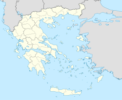
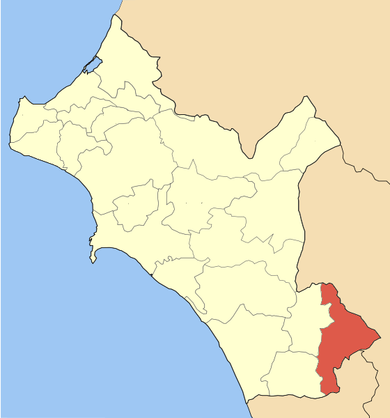
Basisdaten
Staat: Griechenland
Verwaltungsregion: Westgriechenland
Präfektur: Elis
Geographische Koordinaten: 37° 39′ N, 21° 54′ O37.64694444444421.9038888888897Koordinaten: 37° 39′ N, 21° 54′ O
Höhe ü. d. M.: 534 m
(Durchschnitt)
Fläche: 131,247 km²
Einwohner: 2.152 (2001[1])
Bevölkerungsdichte: 16,4 Ew./km²
Gemeindelogo:
Gemeindelogo von Gemeinde Andritsena}}}
Sitz: Andritsena
LAU-1-Code-Nr.: 140500
Gemeindegliederung: 10 Gemeindebezirke
Website: www.andritsaina.gr
Lage in der Präfektur Elis
Bild:Dimos Andritsenis.png

Andritsena (griechisch Ανδρίτσαινα (f. sg.), auch Andritsaina) ist eine Gemeinde und ein Stadtbezirk im Südosten der Präfektur Elis in Griechenland mit 2.152 Einwohner. Die antike Stadt Andritsaina gehörte zur Region Arkadien.

Andritsena liegt in einer Höhe von ungefähr 750 Metern (höchster Punkt bis 1000 Meter) im gebirgigen Herzland zwischen Olympia und Tripoli an der Nationalstraße 76 zwischen Skillounta and Megalopoli. Das malerische Dorf ist häufig Durchgangsstation für Touristen, die den 14 Kilometer südlich gelegenen Apollontempel bei Bassae besuchen möchten.

Gemeindegliederung

  • Andritsena mit
    • Karmio
    • Myli
    • Sykies
  • Chelidoni
  • Dafnoula
  • Dragogi mit
    • Kastroungaina
    • Platia
  • Fanari
  • Koufopoulo
  • Linistena
  • Matesi
  • Thisoa
  • Rovia
  • Sekoula mit
    • Baleika

Einwohner

1991 hatte die Gemeinde noch 2.511 Einwohner. Diese Zahl sank bis 2001 auf 2.152.

Einzelnachweise

  1. Informationen des griechischen Innenministeriums

Wikimedia Foundation.

Игры ⚽ Нужен реферат?

Schlagen Sie auch in anderen Wörterbüchern nach:

  • Andritsaina — Infobox Greek Dimos name = Andritsaina name local = Ανδρίτσαινα periph = West Greece prefec = Elis province = population = 2152 population as of = 2001 population ref = [http://web.archive.org/web/20060413201756/http://www.statistics.gr/gr… …   Wikipedia

  • Andritsaina — 37° 29′ 02″ N 21° 54′ 19″ E / 37.483849, 21.905365 …   Wikipédia en Français

  • Andritsena — Andritsaina 37°38′49″N 21°54′14″E / 37.64694, 21.90389 Andritsaina, ou aussi Andritsena (Ανδρίτσαινα), est une commune de la Préfecture d …   Wikipédia en Français

  • Daphnoula — Dafnoula Δαφνούλα Location …   Wikipedia

  • Matesi — Μάτεσι Location …   Wikipedia

  • Ilia Prefecture — Infobox Pref GR name = Elis name local = Νομός Ηλείας periph = West Greece capital = Pyrgos population = 198,763 population as of = 2005 pop rank = 13th pop dens = 75.9 popdens rank = 13th area = 2,618 area rank = 22nd postal code = 27x xx area… …   Wikipedia

  • Greek National Road 76 — (Pyrgos Andritsaina Megalopoli) is a west to east highway linking 2 km W of Krestena with GR 9/E55, Andritsaina and SE of Megalopoli (until 2003, in Megalopoli). The highway west to Andritsaina is unofficially designated as GR 76 The west to …   Wikipedia

  • Karmio — Karmi or Karmio (Greek, Modern: Κάρμιο, Katharevousa: ον), older form: o and on is a little village located 7 km northeast ofAndritsaina and is also in that municipal district and the municipality, its 2001 population was 23 for the village and… …   Wikipedia

  • Rovia — (Greek: Ρόβια) is a little village near Andritsaina, its 2001 population was 44 for the village and is ranked 6th in the municipality. Rovia is connected with the GR 76 (Megalopoli Andritsaina Krestena Pyrgos) along with several other roads.… …   Wikipedia

  • Kato Samiko — Κάτω Σαμικό Location …   Wikipedia

Share the article and excerpts

Direct link
Do a right-click on the link above
and select “Copy Link”