- Laboule
-
Laboule 

Region Rhône-Alpes Département Ardèche Arrondissement Largentière Kanton Valgorge Gemeindeverband Communauté de communes du Pays Beaume Drobie Koordinaten 44° 35′ N, 4° 10′ O44.5880555555564.1658333333333676Koordinaten: 44° 35′ N, 4° 10′ O Höhe 676 m (393–1.410 m) Fläche 17,45 km² Einwohner 141 (1. Jan. 2008) Bevölkerungsdichte 8 Einw./km² Postleitzahl 07110 INSEE-Code 07118 Website http://laboule.village.free.fr/ 
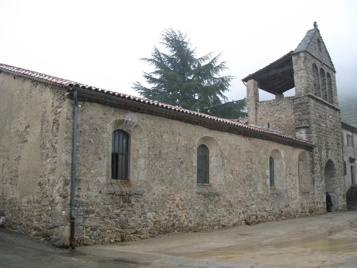
DorfansichtLaboule ist eine französische Gemeinde mit 141 Einwohnern (Stand 1. Januar 2008) im Département Ardèche in der Region Rhône-Alpes.
Inhaltsverzeichnis
Geografie
Laboule liegt in den Cevennen im hoch über dem Tal des Wildflusses Beaume und ist Teil des Regionalen Naturparks Monts d’Ardèche.
Bevölkerung
Bevölkerungsentwicklung
(Quelle: INSEE[1])1962 1968 1975 1982 1990 1999 2004 145 127 92 111 108 112 132 Ab 1968 offizielle Zahlen ohne Einwohner mit Zweitwohnsitz Einzelnachweise
Weblinks
 Commons: Laboule – Sammlung von Bildern, Videos und Audiodateien
Beaumont | Dompnac | Laboule | Loubaresse | Montselgues | Saint-Mélany | Valgorge
Wikimedia Foundation.
Schlagen Sie auch in anderen Wörterbüchern nach:
Laboule — Laboule … Wikipedia Español
Laboule — 44° 35′ 19″ N 4° 10′ 00″ E / 44.5886111111, 4.16666666667 … Wikipédia en Français
Laboule — Infobox Commune de France nomcommune=Laboule région=Rhône Alpes département=Ardèche arrondissement=Largentière canton=Valgorge insee=07118 cp=07110 maire=Jean Pierre Caretti mandat=2001 2008 intercomm=Pays Beaume Drobie longitude=4.16666666667… … Wikipedia
Valgorge — 44° 35′ 17″ N 4° 07′ 47″ E / 44.5880555556, 4.12972222222 … Wikipédia en Français
Elie Lescot — Élie Lescot (* 9. Dezember 1883 in Saint Louis du Nord (Departement Nord Ouest); † 20. Oktober 1974 in Laboule) war ein haitianischer Politiker und Präsident von Haiti. Inhaltsverzeichnis 1 Biografie 1.1 Berufliche und politische Laufbahn … Deutsch Wikipedia
Beaumont (Ardèche) — Pour les articles homonymes, voir Beaumont. 44° 32′ 20″ N 4° 10′ 03″ E … Wikipédia en Français
La Souche — 44° 37′ 48″ N 4° 11′ 53″ E / 44.63, 4.19805555556 … Wikipédia en Français
Communaute de communes du Pays Beaume Drobie — Communauté de communes du Pays Beaume Drobie Communauté de communes du Pays Beaume Drobie Administration Pays … Wikipédia en Français
Communauté De Communes Du Pays Beaume Drobie — Administration Pays … Wikipédia en Français
Communauté de communes du Pays-Beaume Drobie — Administration Pays … Wikipédia en Français
Laboule

18+
© Academic, 2000-2024
- Kontaktieren Sie uns: Unterstützung, Werbung
Wörterbücher Export, schritte mit PHP, Joomla, Drupal, WordPress, MODx.