- Lake Fryxell
-
 Fryxellsee
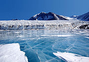 Der Fryxellsee
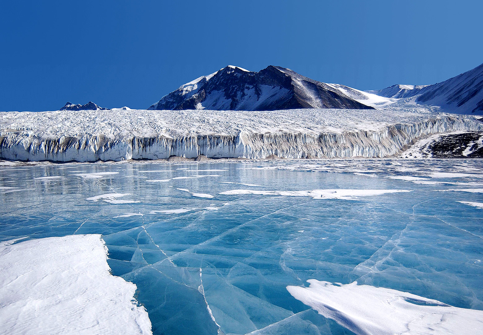
Der Fryxellsee (engl. Lake Fryxell) ist ein etwa viereinhalb Kilometer langer See zwischen dem Kanada- und dem Commonwealth-Gletscher in Viktorialand im Süden des antarktischen Kontinents. Er befindet sich innerhalb der Antarktischen Trockentäler bei 77° 37' südlicher Breite und 163° 11' östlicher Länge. Der Fryxellsee wurde von der Terra-Nova-Expedition (1910 bis 1913) unter Sir Robert Falcon Scott entdeckt und kartografiert. 1957 nach Dr. Fritiof Fryxell, einem Glazialgeologen des Augustana College in Illinois (USA) benannt.
Der See beheimatet wie viele andere antarktische Seen auch eine große Anzahl prokaryontischer Lebewesen.
Weblinks
- Antarktische Seen: ein Eldorado für Prokaryonten
- Suche nach Veröffentlichungen über den Fryxellsee im Australian Antarctic Data Centre
-77.616388888889163.18305555556Koordinaten: 77° 36′ 59″ S, 163° 10′ 59″ O

Wikimedia Foundation.